This is the Colorado-Big Thompson Project.
12 Reservoirs 35 Miles of Tunnels 95 Miles of Canals 6 Hydroelectric Plants
12 Reservoirs 35 Miles of Tunnels 95 Miles of Canals 6 Hydroelectric Plants
What is the C-BT project? First, let’s rewind.
In part due to the Sugar Beet boom, the populations of communities along the Poudre continued to grow at unprecedented rates during the early 1900s. This same region, however, has a long history over the limited supply of water several competing communities rely on (see our page on “Water Wars”). As population and agriculture along the Poudre continued to grow, so did demands on the limited but valuable supply of water in the Poudre and other rivers along the Front Range.
Colorado is a headwater state. This means much of the nation’s water originates here. In fact, four of the nation’s major rivers (Colorado, Platte, Arkansas, and Rio Grande) originate in the state, and many smaller rivers, including the Poudre, feed these major rivers, contributing water that flows out of the state, heading either to the Pacific or Atlantic oceans depending on which side of the Continental Divide the precipitation falls on. (In fact, only three rivers flow into Colorado and only in small stretches). Because of the prevailing westerly winds of the northern hemisphere’s mid latitudes, approximately 80% of Colorado’s water falls on the west side of the Continental Divide (largely as snowfall). However, both historically and today, approximately 80% of Colorado’s population, as well as a large majority of its irrigated agriculture, can be found on the east side of the divide, separated from most of the state’s water by the impenetrable Rocky Mountains.
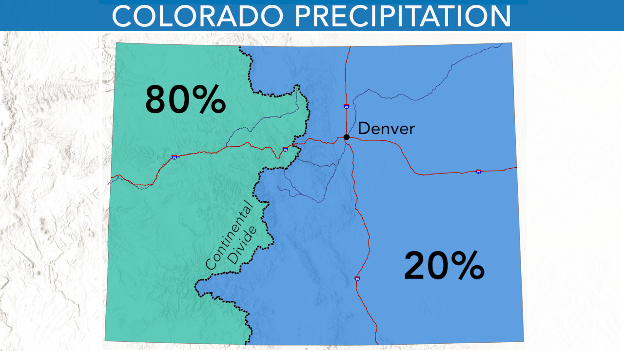
Map of average annual precipitation distribution in Colorado. Courtesy of Denver Water
In the early decades of the twentieth century, the dramatic agricultural and population growth of communities like Greeley and Fort Collins continued to test the limits of the local network of ditches, reservoirs, and trans-basin diversions. The desperately dry 1930s and the Great Depression accentuated the need for more dependable water. Residents along the Poudre looked, as others had, longingly toward the Continental Divide, where, on the other side, large quantities of still-untapped Colorado River water flowed westward.
Residents of the eastern slope had already experimented with transmountain diversion (moving water from one side of the mountains to the other). In the late nineteenth century, small, crude ditches collected high-altitude snowmelt and diverted it using gravity through mountain passes from one watershed to another. The Grand River Ditch, diverting water from the Upper Colorado River basin to the South Fork of the Cache la Poudre River (via la Poudre Pass) is a good example. However, no ditch company had the technical or financial resources needed to build infrastructure on the scale needed to move water from the Colorado River on the western slope through the mountains and into rivers like the Poudre.
In 1889 the state of Colorado has surveyed thee potential of diverting water from Grand Lake on the western slope to the South Platte River Basin on the eastern side, but the results were deemed unfavorable. Again in 1902 the newly established Bureau of Reclamation had considered constructing a trans-basin diversion from Grand Lake to the eastern slope, but chose not to pursue it. By the 1930s, however, desperate northern Colorado farmers were ready to explore the idea again. In August 1933, Northern Colorado leaders organized the Grand Lake Committee—the predecessor to the Northern Colorado Water Conservancy District (known as Northern Water)—to pursue the idea of a trans basin, transmountain diversion project. By December, engineers reported the project could be feasible. By 1937 Northern Water is officially created and the project has gained widespread support on the eastern slope.
In June of 1937 Senator Alva B. Adams presents the project to Congress, it receives authorization. Not all Colorado residents supported the project. Water history in Colorado has always contained conflict, the resource is one of the most precious in the state. Understandably, western slope residents were concerned over water being diverted away from their rivers, others were concerned over impacts the project might have to Rocky Mountain National Park, less than 30 years old at the time. Still others were concerned about the cost. Proponents of the project won out. In November 1938 the first construction projects kicked off as Northern Water, together with the US Bureau of Reclamation began the Colorado-Big Thompson Project.
The scope of the project was immense, and would cost approximately $164 million when finally completed in 1956. On the western slope, a collection system traps runoff from the high mountains and then stores and conveys the water to the Alva B. Adams Tunnel which runs under the Continental Divide. The tunnel itself was one of the main feats of engineering of the project. Construction began on June 23, 1940 and contractors bored the tunnel simultaneously from opposite sides of the mountain. When the crews met beneath the Continental Divide four years later on June 10, 1944 the event was televised live on NBC—the alignment of the tunnels was off by less than the width of a penny. When it was built, the Alva B. Adams Tunnel was the longest tunnel in the US providing water for irrigation. It is ten feet in diameter and concrete-lined, dropping 109 feet in elevation between the west and east portals, allowing the water to flow via gravity without the need for pumps. It takes a drop of water about 2 hours to travel through the tunnel, and the mountains.
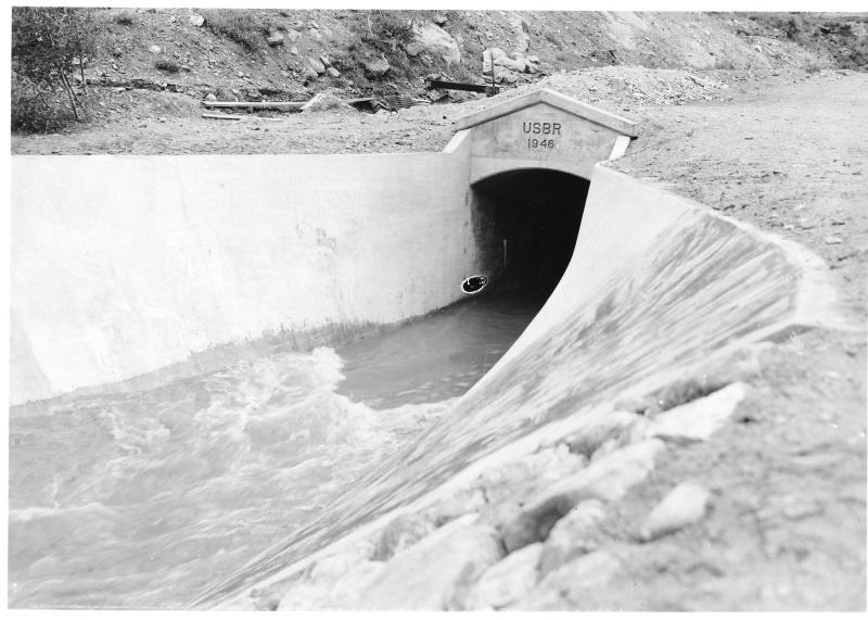
View of the first water coming through the East Portal of the Alva B. Adams Tunnel in Colorado. June 23, 1947. Harry S. Truman Library. 2013-1169
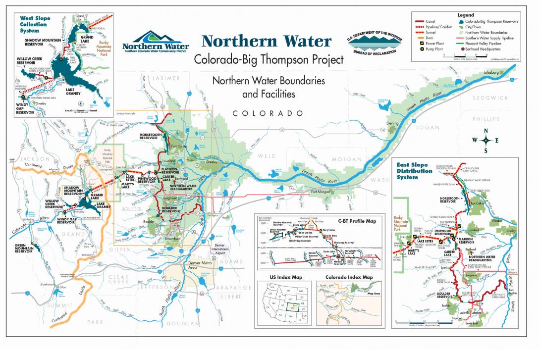
Once the water flows through the Adams Tunnel it passes through aa system of pipelines, canals, hydropower plants, and reservoirs before it reaches its users. Reservoirs on the eastern slope include Lake Estes, Mary’s Lake, Flatiron Reservoir, Pinewood Reservoir, Boulder Reservoir, Carter Lake, and Horsetooth Reservoir.
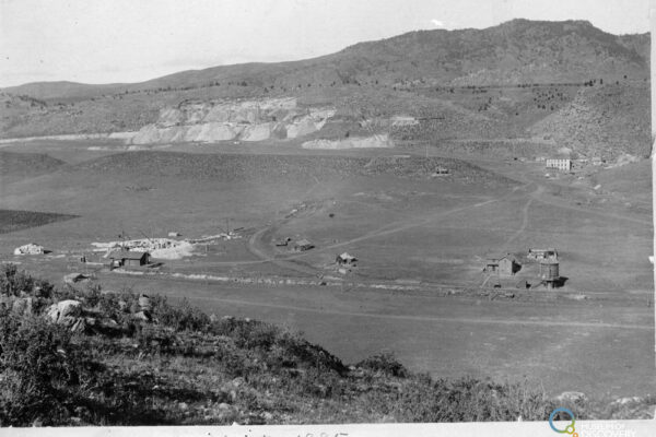
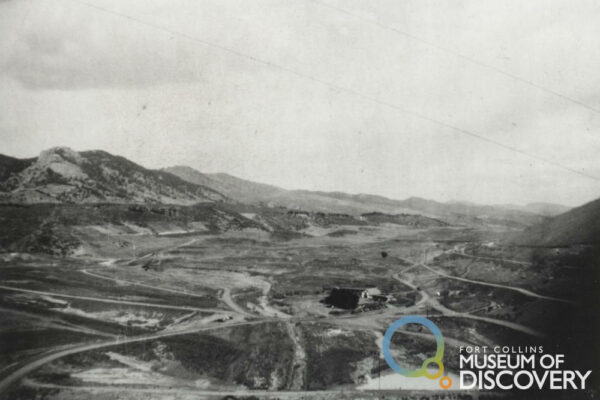
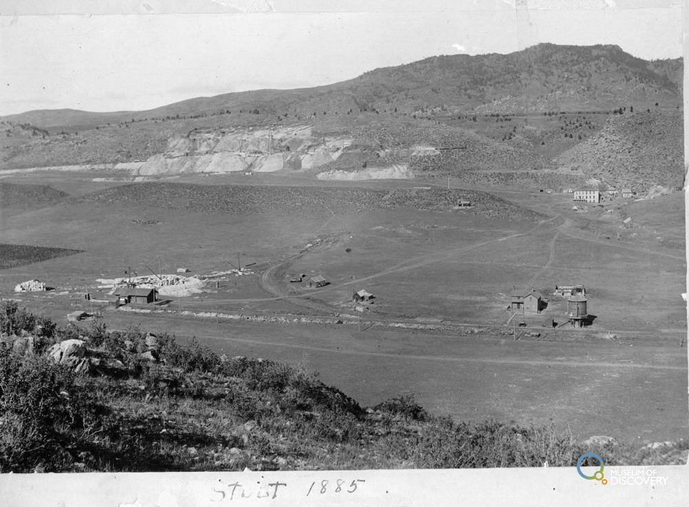
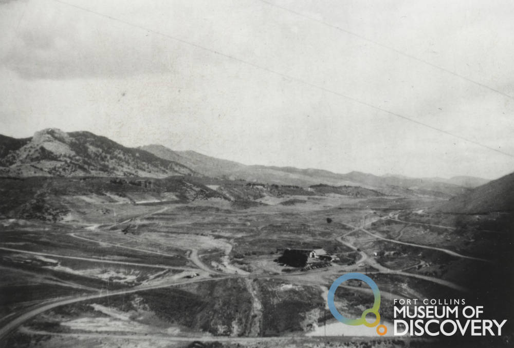
Horsetooth Reservoir, stretching 6.5 miles to the west of Fort Collins, might be familiar to those who currently live along the Poudre as it has become a recreation destination for many! Next time you visit Horsetooth remember that water began on the other side of the Rocky Mountains. The creation of Horsetooth in and of itself was complex and involved the demise of the quarry town of Stout which today lies under the Reservoir. In 1951 the first water was stored in Horsetooth and subsequently released into the Poudre River by the Hansen supply canal.
In all the C-BT system spans 150 miles east to west and 65 miles north to south. Today, Northern Water and the US Bureau of Reclamation jointly operate the C-BT Project, which is owned by the federal government. Northern Water is responsible for monitoring water quality, weather data, tracking stream flows and reservoir levels, and providing resource planning.
Northern Water is also responsible for apportioning the water used for irrigation to more than 120 ditches and 60 reservoirs. The project diverts approximately 260,000 acre-feet of water annually (310,000 acre-feet maximum) from the Colorado River headwaters on the western slope to the Big Thompson & Poudre Rivers on the eastern slope. It remains one of the largest and most complex projects undertaken by the Bureau of Reclamation.
The western slope and users on the Colorado River do have rights to water as well. The C-BT project has a maximum number of acre feet that can be diverted each year. Reservoirs on the western slope constructed during the C-BT project also ensure water that stays on the western side can be stored during spring runoff and later released to maintain the flow of the Colorado River.
Colorado Big-Thompson water remains immensely valuable to the communities and farmers that rely on it. In fact, it has become immensely valuable. When first completed, a share of C-BT water cost around $1.50, in 2024 one share was worth about $52,000.
If you live in a community along the Poudre, the next time you turn on a tap remember that water may have started on the other side of the mountains out your window. Only through massive feats of engineering and persistence did it make it into your cup.
Northern Water, the managing entity of C-BT water on the western slope has extensive history, timelines, videos, and photos on the project. Learn more at https://www.northernwater.org/deliver-water/colorado-big-thompson-project
Learn about the controversy of the C-BT Project from History Colorado https://www.historycolorado.org/story/2023/02/14/colorados-forgotten-diversion-dilemma
The C-BT Project is a massive, trans regional system that can be hard to visualize in scale. Northern Water, a manager of much of the water in the Poudre region, has created a small-scale replica of the C-BT system with interpretation at their offices in Berthoud, the water feature operates April-October. Check it out and get a better sense of how this massive system brings water to the reservoirs, canals, and taps of Northern Colorado!
You can recreate on C-BT water. Visit Horsetooth Reservoir or Carter Lake! Both are man-made reservoirs created as part of the C-BT project!
Colorado-Big Thompson Project. US Bureau of Reclamation. Colorado. https://www.usbr.gov/projects/index.php?id=432
Colorado-Big Thompson Project. Colorado Encyclopedia from History Colorado. https://coloradoencyclopedia.org/article/colorado-big-thompson-project
Colorado-Big Thompson Project. Northern Water. https://www.northernwater.org/deliver-water/colorado-big-thompson-project
History Timeline. Northern Water. https://www.northernwater.org/about-us/history
 |
 |
 |
© 2026 Cache la Poudre River National Heritage Area.
Web design by Mt. Bailey Productions | Privacy Policy
Photography by Gabriele Woolever unless otherwise credited.