Your Full Name*
Grade Level:*
Your Teacher's Name
If you were assigned this route as a class or by your teacher, please write their name above.
Your Guardian's Email*
Date Completed* Which Route Did You Take?* Select the route you completed to answer questions about each point of interest!
Greeley's Number 3 - Points of Interest (Walking) POI #1: Poudre Learning Center - Eagle Tower It’s hard to imagine what this area looked like before it was touched by any human hands. Picture
a bounty of rolling prairie hills with tall grasses and lush greenery surrounding a calm, meandering
river. Agriculture (farming), recreation (fun activities), industry (work opportunities), and
residential areas (houses) have since changed this land surrounding the Poudre River. Look all
around you and answer the following questions:
1. How has human activity affected the environment here? (Give at least 3 specific examples).
2. What efforts does it look like are being taken to keep this land protected and beautiful?
3. Locate the blue-bordered Cache la Poudre River National Heritage Area (CALA) sign that surrounds the base. You are viewing one of four CALA signs. Share a date/time frame and one piece of information from the “Timeline” section on the right side of the sign.
POI #2: The Narrows and Signature Bluffs Sometimes nature, although it is beautiful, can have dangerous effects if you are not careful.
Look at the caution signs at POI #2. Record what the signs say, and come up with a plan to
continue safely down the trail.
What does Sign 1 say?
What does Sign 2 say?
What is your plan to continue safely down the trail?
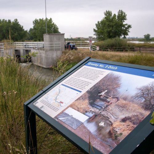
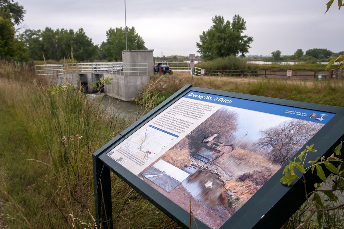
POI #3: Greeley No. 3 Ditch Figure out how old this irrigation ditch is by following the formula below. Look at the sign that says
“Greeley No. 3 Ditch” and find out when the ditch was built. Fill in the information and solve.
Current Year - Year Ditch Was Built
How many years does this calculate to?
POI #4: 71st Avenue Trailhead Once you see the big red barn, you’ll know you’re almost there. Look at the large sign that says “The Poudre River Trail” at the top. You will see a white map in the middle of the sign with a red dot labeled “You Are Here.” Answer the following questions:
1. Which two roads are you between right now? CR _____ and CR ____
2. Which two avenues are you between right now? _____ Ave and _____ Ave
3. Which direction will you be heading if you turn around right now and head back down the path? 4. The blue line on the map represents the ______________
and the yellow line on the map represents the __________________________.
End of Route Summary Write the sensory details you noticed: Hear, See, Feel, Smell
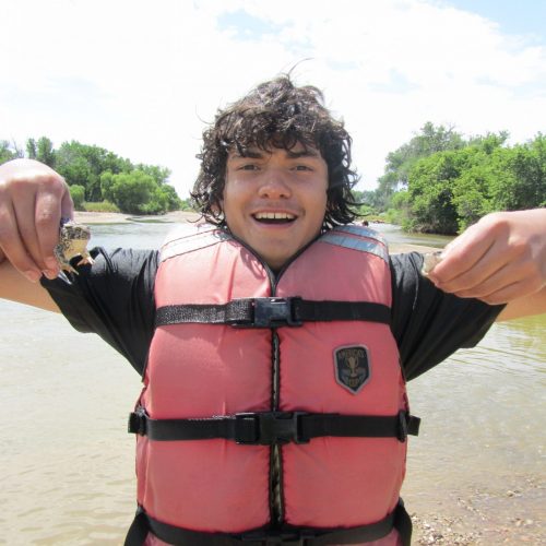
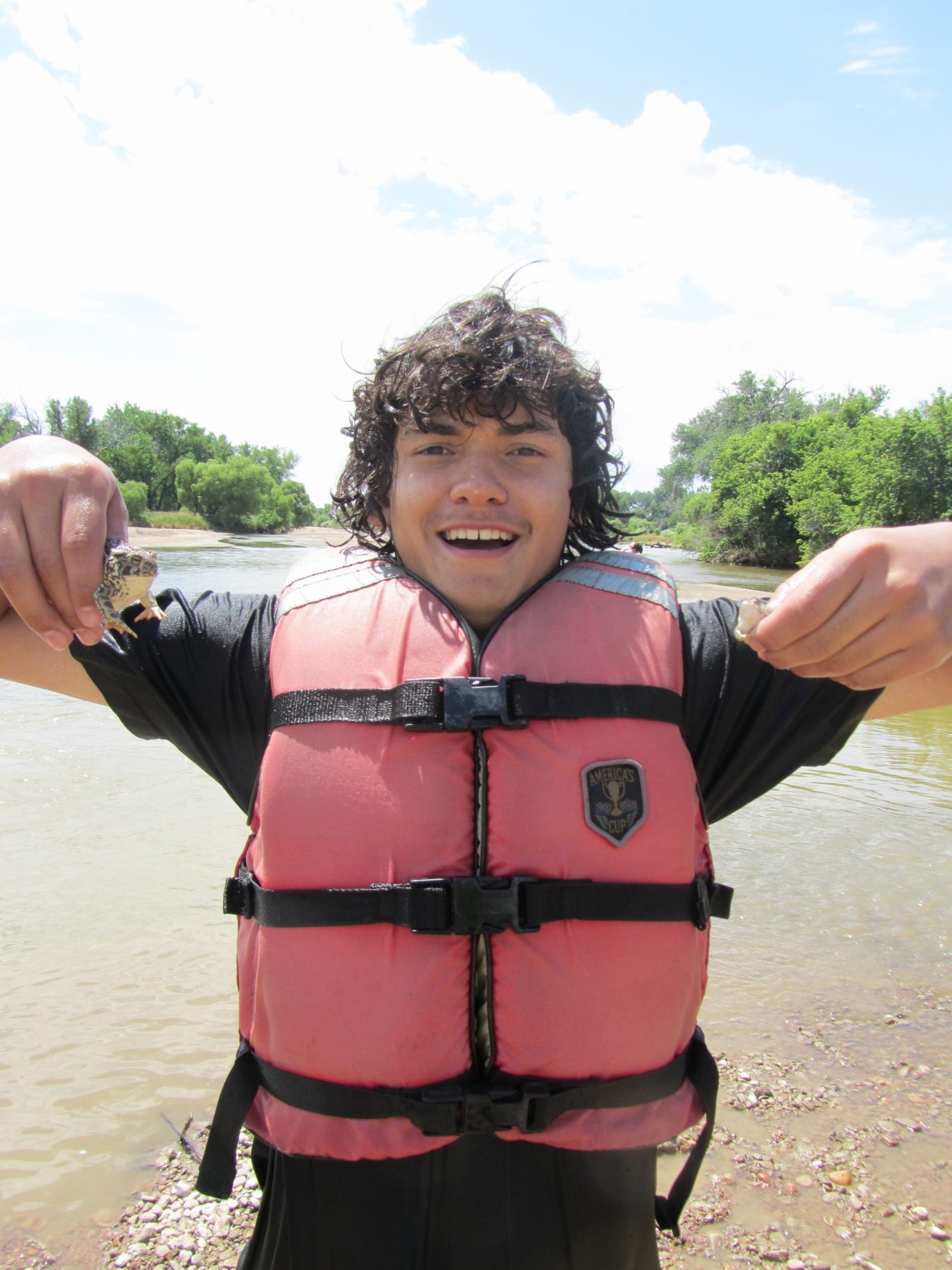
Upload Your Seasonal Selfies Here! Greeley's Number 3 - Points of Interest (Biking) POI #1: Poudre Learning Center - Eagle Tower It’s hard to imagine what this area looked like before it was touched by any human hands. Picture
a bounty of rolling prairie hills with tall grasses and lush greenery surrounding a calm, meandering
river. Agriculture (farming), recreation (fun activities), industry (work opportunities), and
residential areas (houses) have since changed this land surrounding the Poudre River. Look all
around you and answer the following questions:
1. How has human activity affected the environment here? (Give at least 3 specific examples).
2. What efforts does it look like are being taken to keep this land protected and beautiful?
3. Locate the blue-bordered Cache la Poudre River National Heritage Area (CALA) sign that surrounds the base. You are viewing one of four CALA signs. Share a date/time frame and one piece of information from the “Timeline” section on the right side of the sign.
POI #2: The Narrows and Signature Bluffs Sometimes nature, although it is beautiful, can have dangerous effects if you are not careful.
Look at the caution signs at POI #2. Record what the signs say, and come up with a plan to
continue safely down the trail.
What does Sign 1 say?
What does Sign 2 say?
What is your plan to continue safely down the trail?
POI #3: Greeley No. 3 Ditch Figure out how old this irrigation ditch is by following the formula below. Look at the sign that says
“Greeley No. 3 Ditch” and find out when the ditch was built. Fill in the information and solve.
Current Year - Year Ditch Was Built
How many years does this calculate to?
POI #4: 71st Avenue Trailhead Once you see the big red barn, you’ll know you’re almost there. Look at the large sign that says “The Poudre River Trail” at the top. You will see a white map in the middle of the sign with a red dot labeled “You Are Here.” Answer the following questions:
1. Which two roads are you between right now? CR _____ and CR ____
2. Which two avenues are you between right now? _____ Ave and _____ Ave
3. Which direction will you be heading if you turn around right now and head back down the path? 4. The blue line on the map represents the ______________
and the yellow line on the map represents the __________________________.
POI #5: Old Farm Equipment Just after you cross 71st Ave, you’ll see a sign letting you know about the Duran Family who provided their farmlands to the Poudre River Trail. Just past the sign you’ll see a variety of old farm equipment on the south side of the trail.
1. How does the cow look?
2. How does the cow sound?
3. How does the cow smell?
POI #6: Interpretive Sign about area birds You can complete the next two tasks at any point after POI #6 and before POI #8.
POI #6: Task A
Look for two different cause and effect relationships as you are riding your bike and record them below. This can be cause and effect between animals, insects, nature, humans, etc.
POI #6: Task B
If you pay attention to the river as you ride along the trail, you’ll notice that at times you can see rocks in the bottom of the river, and other times you can’t. Why do you think this is? Use one of these words in your response: erosion, weather, or water level.
POI #7: Intersection of the Poudre River Trail and the Sheep Draw TraiI At this trail intersection, turn left (east) to stay on the Poudre River Trail and start looking for Prairie Dog Mounds. After you continue left at the fork in the trail, you’ll notice prairie dog mounds in the dirt along both sides of the trail. Observe the mounds for a few minutes and answer the questions.
1. How have prairie dogs altered the surrounding area?
2. Why do you think prairie dogs choose to live underground?
3. How do you think prairie dogs obtain the food that gives them energy to grow and live?
POI #8: Boyd and Freeman Ditch Headgate Read the passage below about the Boyd and Freeman Ditch. Then, underline the problem and circle the solution.
"Rain is a vital part of any ecosystem; however, too much rain can lead to flooding and overflowing of rivers. It is for this reason that diversion ditches, such as the Boyd and Freeman Ditch, are built. The excess water is used to irrigate the surrounding land, which helps the land flourish."
At this point the trail continues east, while the river meanders north before turning east again. The Boyd and Freeman Ditch has a #6 priority from the Poudre River, and was established in 1862
Be sure to upload your seasonal selfie with the headgate in the background below!
End of Route - You Did It! Upload Your Seasonal Selfies Here! Past, Present, and Future Fort Collins - Points of Interest (Biking) Pre-Route Reflection: 1) Using the following two prompts, write one paragraph (5-8 sentences):
a) Describe how you have interacted with the Cache la Poudre River in the pas:
b) Describe the ecological role of the river and the services it provides to the natural environment of the area including a list of all plants and animals that you believe are dependent on the river:
Or Upload Your Reflection Here POI #1: Trail Crosses Ditch The Cache la Poudre River National Heritage Area is crisscrossed with numerous canals and ditches. These ditches were created to move water into and out of the river to support human efforts like agriculture, drinking water and mining. Some of these are no longer routinely used, others are still used daily (during certain times of year) to move water to water rights owners and municipalities who use them to grow crops, provide drinking water, irrigate parks, and move unused or reclaimed water back into the river.
1. The headgate can be opened to allow water to flow through an area 3 feet wide by 3 feet high by 3 feet long. This area can be filled in approximately 1 second. What is the volume of water that can be moved through this gate in one minute? Write out an equation that shows your answer.
2. Do you think these ponds are human made or were here hundreds of years ago? What leads you to your answer? If you answered they were human made, you’re correct! What led to these ponds being created? What is this material used for? How is this material a part of your life?
POI #2: NHA Interpretive Sign The Cache la Poudre River is designated as a National Heritage Area. As the sign says, this has to do with the role of this river in influencing water law, as well as its influence on the cultural heritage of the region.
1. Can you list some of the different human activities that have been dependent on the Cache la Poudre River for the past thousand years?
2. What six towns shown on this map are part of the Heritage Area?
3. Why do you think humans choose to make their cities by bodies of water?
POI #3: River Up or River Down Interpretive Sign - McMurry Natural Area River Gage This site shows a river gauge on the far side of the river on the concrete pillar. It also features an artistic bridge and connection to the McMurry Natural Area which features riparian vegetative zones adjacent to rivers and several reclaimed gravel pits that are now functioning as wetlands.
1. Regardless of what the flow is today, if there are 200 cfs (cubic feet per second) in the river today. How many gallons of water are flowing by this bridge every second? Show your equation.
2. Note the artwork on the bridge. What does it represent? Do you know what species of fish live in this area of the Cache la Poudre River? Are any of these species native fish?
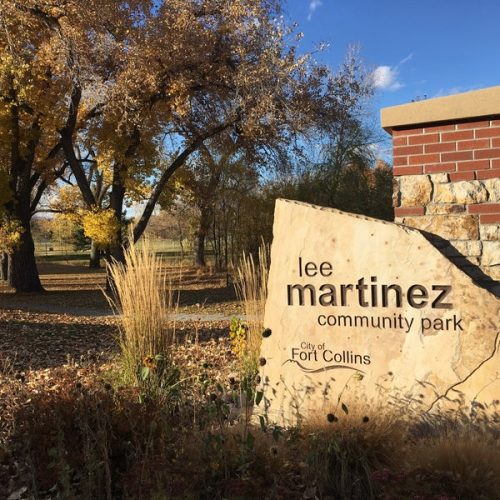
POI #4: Interpretive Kiosk near Lee Martinez Park Lee Martinez is noted for helping to build community in Fort Collins. The Cache la Poudre River has a long history of diverse human cultures who have made and called it their home. Sites around the Cache la Poudre have evidence of some of the oldest human uses in North America! Over the past one hundred years, diverse people from many different cultures have come to the Cache la Poudre to make a home.
1. What does the word “heritage” mean to you? When and why did you and your family come to Fort Collins?
2. Like Lee Martinez, how do you work to build and benefit the community cultivated by the Cache la Poudre River?
3. Look at the ride side kiosk sign - In between which two Fort Collins’ Natural Areas are you standing between right now?
POI #5: Lake Canal Wayside Interpretive Sign This site identifies one of the earliest conflicts over water in Northern Colorado. In Colorado the right to use water is given to individuals, cities, or groups. Every bit of water we drink or use is appropriated (meaning given ownership and purpose).
1. Where did the communities of Fort Collins and Greeley meet to settle the 1874 conflict over the Lake Canal?
2. Do you know who owns the right to the water you and your family use?
POI #6: Whitewater Park-Old Coy Ditch Diversion Structure This is the site of a former agricultural diversion ditch that was no longer used. The diversion structure was removed and a whitewater park was created for river play, tubing, and kayaking. The Poudre Heritage Alliance's Play It Safe on the Poudre program raises awareness about approaches to recreating on the river in safe and sustainable ways. The program also calls attention to the history of in-river structures that represent hazards to recreation.
1. Both recreation like kayaking and tubing, and eating healthy are important for your health and well-being. List several of your favorite physical activities you like to pursue as well as your favorite fruit and vegetables that are grown in Colorado
2. In what ways can locally grown food be better for you and for the environment?
POI #7: Informational Kiosk in Heritage Park During this learning adventure, you have had the opportunity to think about the role the Cache la Poudre River plays in many different parts of the natural and human communities of our area. The water in the river is what makes it a river! Because water is so important to human lives and human endeavors like agriculture and recreation and is essential for wildlife, native plants, and the ecology of the region, there are many different views on water and its use. Water laws work to balance these views and demands on water. These laws, along with technology, continue to change how water is stored, delivered, used, and reused in the Cache la Poudre River, where many of these challenges were first experienced, over 150 years ago and where many of the solutions for the future of rivers and communities throughout the West continue to be discovered.
1. Did you know there are laws about water? Did you know that water is actually owned?
2. If water wasn’t protected by laws, and if everyone could just use what they wanted, what do you think would happen?
Share how you ranked your water uses below:
Rank the following water uses from 1-5 (one being the most important) based on how you feel water should be used:
- Recreation
- Drinking water for people
- Water for wildlife (fish, animals, plants)
- Agriculture (Farming, ranching)
- Landscaping (lawns, parks, trees around town and in your neighborhood)
End of Route Summary What human uses did you observe alongside the river corridor and in the river from the route you chose?
Upload Your Seasonal Selfies Here! Write Your Summative Reflection Here
Write two paragraphs (5-7 sentences each) based on the following prompts:
i. What are two takeaways (things you felt you learned and will remember)
from your learning adventure?
ii. Describe your feelings about the Cache la Poudre River
Or Upload Your Reflection Here Past, Present, and Future Fort Collins - Points of Interest (Walking) Pre-Route Reflection: 1) Using the following two prompts, write one paragraph (5-8 sentences):
a) Describe how you have interacted with the Cache la Poudre River in the pas:
b) Describe the ecological role of the river and the services it provides to the natural environment of the area including a list of all plants and animals that you believe are dependent on the river:
Write Your Pre-Route Reflection Here
Or Upload Your Reflection Here POI #1: Heritage Park Kiosk During this learning adventure, you will have the opportunity to think about the role the Cache la Poudre River plays in many different parts of the natural and human communities of our area. The water in the river is what makes it a river! Because water is so important to human lives and human endeavors like agriculture and recreation and is essential for wildlife, native plants, and the ecology of the region, there are many different views on water and its use. Water laws work to balance these views and demands on water. These laws, along with technology, continue to change how water is stored, delivered, used, and reused in this river where many of these challenges were first experienced over 150 years ago.
1. There is a wealth of information on this kiosk about the history of the Cache la Poudre River National Heritage Area. Write down something new that you learned from this Kiosk!
2. Did you know there are laws about water? Did you know that water is actually owned?
3. Record how you ranked the water uses shared in your Walking Route Map under this POI.
Rank 1-5: (One being most important)
- Recreation
- Drinking Water for People
- Water for Wildlife (fish, animals, plants)
- Agriculture (farming and ranching)
- Landscaping (lawns, parks, and trees around town and in your neighborhood)
POI #2: New Whitewater Park and Old Coy Ditch Diversion Structure This is the site of a former agricultural diversion ditch that was no longer used. The diversion structure was removed and a whitewater park was created for river play, tubing and kayaking. The Poudre Heritage Alliance's Play It Safe on the Poudre program raises awareness about approaches to recreating on the river in safe and sustainable ways. The program also calls attention to the history of in-river structures that represent hazards to recreation.
1. In what ways can locally grown food be better for you and for the environment?
2. Both recreation like kayaking and tubing, and eating healthy are important for your health and well-being. List several of your favorite physical activities you like to pursue as well as your favorite fruit and vegetables that are grown in Colorado
POI #3: Lake Canal Wayside Interpretive Sign This site identifies one of the earliest conflicts over water in Northern Colorado. In Colorado the right to use water is given to individuals, cities, or groups. Every bit of water we drink or use is appropriated (meaning given ownership and purpose).
1. Where did the communities of Fort Collins and Greeley meet to settle the 1874 conflict over the Lake Canal?
2. Do you know who owns the right to the water you and your family use?
POI #4: Interpretive Kiosk Near Lee Martinez Park Lee Martinez is noted for helping to build community in Fort Collins. The Cache la Poudre River has a long history of diverse human cultures who have made and called it their home. Sites around the Cache la Poudre have evidence of some of the oldest human uses in North America! Over the past one hundred years, diverse people from many different cultures have come to the Cache la Poudre to make a home.
1. What does the word “heritage” mean to you? When and why did you and your family come to Fort Collins?
2. Lee Martinez was celebrated for his work in integrating the communities of Fort Collins. How do you work to build and benefit the community cultivated by the Cache la Poudre River?
3. Look at the ride side kiosk sign- In between which two Fort Collins’ Natural Areas are you standing between right now?
POI #5: River Up or River Down Interpretive Sign -McMurry Natural Area River Gage This site shows a river gauge on the far side of the river on the concrete pillar. It also features an artistic bridge and connection to the McMurry Natural Area which features riparian vegetative zones adjacent to rivers and several reclaimed gravel pits that are now functioning as wetlands.
1. Regardless of water flow on the day you went, how many gallons of water are flowing by this bridge every second? Show your equation.
2. Note the artwork on the bridge. What does it represent? Do you know what species of fish live in this area of the Cache la Poudre River? Are any of these species native fish?
End of Route Summary As you walk back think about what human uses can you observe alongside the river corridor and in the river from the route you take?
Upload Your Seasonal Selfies Here! Write Your Summative Reflection Here
Write two paragraphs (5-7 sentences each) based on the following prompts:
i. What are two takeaways (things you felt you learned and will remember)
from your learning adventure?
ii. Describe your feelings about the Cache la Poudre River
Or Upload Your Reflection Here Submit I hereby agree to the terms and conditions stated below:* I agree to participate in the SOLO Field Trip Program (“Program”) and that all text and images submitted to Cache la Poudre River National Heritage Area/Poudre Heritage Alliance (“Sponsors”) associated with the Program may be used and reused by the Sponsors for purposes of illustration, advertising, promotion, display or publication, and for any other lawful, non-commercial use. This consent has no limits as to media, territory or time. I understand that these images may be cropped, edited or otherwise altered and that whether any of them is used, and how it is used, is entirely for Sponsor (or its licensees) to decide. I hereby relinquish all rights to review or approve any such use. I hereby authorize the Sponsors to use my name and any biographical data I may provide in connection with this project. I hereby represent and warrant that: I have full authority to grant this consent and release. Nothing herein violates the terms of any affiliation I may have with any third party and I take full responsibility for satisfying all obligations arising from any such affiliation. I HEREBY RELEASE THE CACHE LA POUDRE RIVER NATIONAL HERITAGE AREA, POUDRE HERITAGE ALLIANCE, THEIR SUBSIDIARIES, AFFILIATES, SUCCESSORS AND ASSIGNS, TOGETHER WITH THEIR OFFICERS, DIRECTORS, EMPLOYEES, REPRESENTATIVES, AGENCIES AND LICENSEES, FROM ALL LIABILITY IN CONNECTION WITH ANY USE OF THESE ASSETS.
CAPTCHA


