Tag

backpacking

Colorado Heritage Journey: The Trail Life

By News

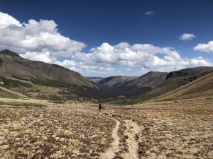
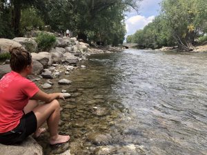
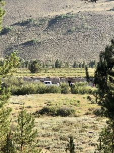
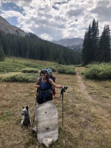
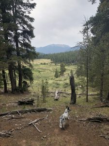
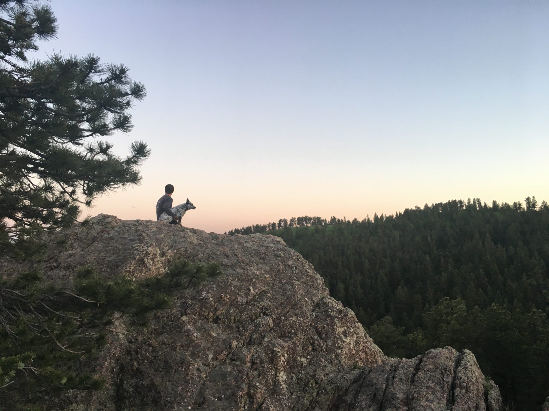
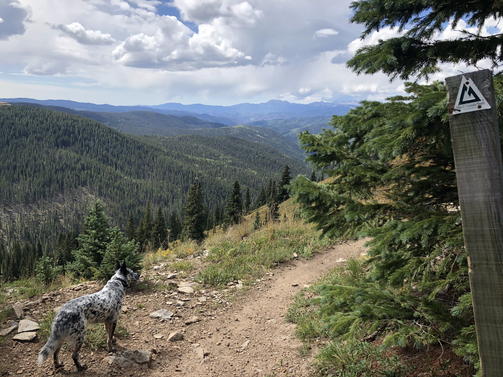
“Trail life” can mean a lot of different things. For Kelsey, Aska, and I during our 400+ mile thru-hike of the Colorado Trail, here is what a typical day looked like: Wake up between 6-6:30am; retrieve the food bag we hung the previous night from a nearby tree to protect us from bears (hopefully); feed our dog Aska and get her paws/pack ready for the day; boil water for coffee and breakfast; pack up our tent, sleeping bags, pads, and other equipment; filter water depending on upcoming water sources; start hiking our average 15 miles per day; stop a couple times along the hike for snacks and lunch; reach camp around 4pm and unpack everything we need for the night; boil water for our dehydrated dinner; hang our bear bag; brush our teeth; watch or read something on our phones; go to sleep.

Many friends and acquaintances during our travels would ask us questions like: “How amazing were the stars at night?” Or “I bet all the campfires were super fun”. However, when your quasi-job for the month involves walking with a 40 lb backpack for 8-10 hours each day, all you really want to do is lay down in your tent and go to sleep at 8pm before the stars even come out. Of course, other people experience different versions of the trail life, which could include horseback riding, ATVs, and lots of campfires. The great thing is that our trail infrastructure is so versatile that it can satisfy the diverse recreational demands of millions of people each year.

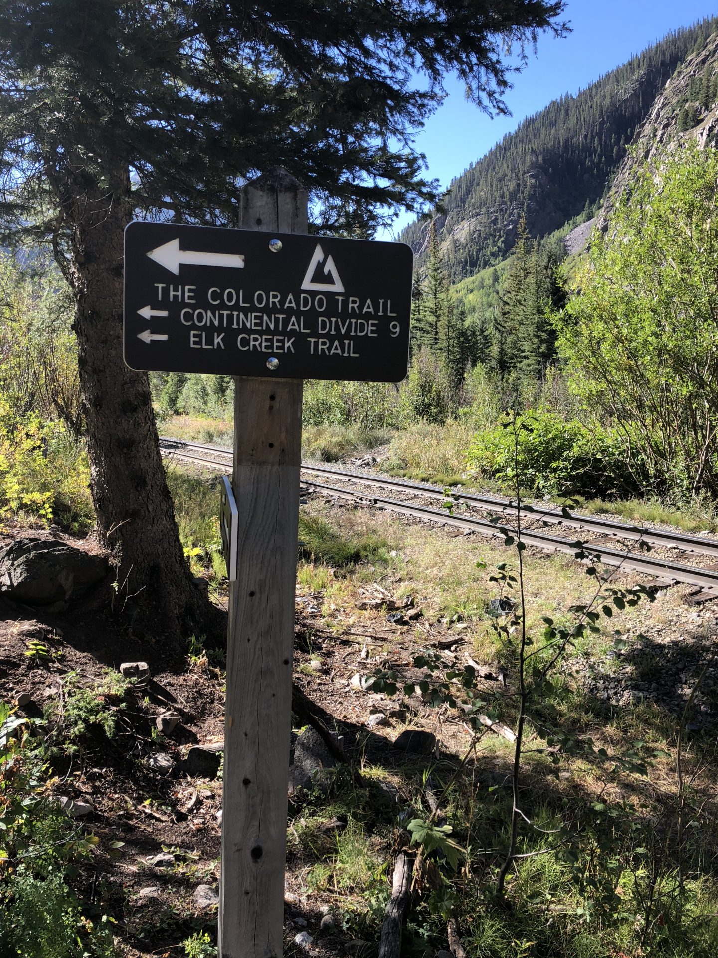
Thanks to our National Trails system, it’s easier than ever to enjoy your time in the outdoors. This year we celebrate the 50th Anniversary of the National Trails Systems Act as well as the 50th year celebration of our Wild and Scenic Rivers. Additionally, the Continental Divide Trail, which is celebrating it’s 40th year as part of that system, is co-located with the Colorado Trail for about 300 miles. This trail is interesting because unlike the more famous Pacific Crest Trail and Appalachian Trail, it still needs some work to be completed from end-to-end.

One of my favorite conversations along the trail was with a Canadian couple that was backpacking a section of the Colorado Trail per a recommendation from their son who thru-hiked the full 2,500+ mile Continental Divide Trail corridor the previous year. The couple explained that Canada contained many great trails, but no real continuous trail systems like in the United States that extend for hundreds and hundreds of miles. They were particularly amazed how most of our trails were “free”, meaning no one was charging them money to hike or camp along the way. I tried to explain how our public lands work in terms of national forests, wilderness areas, and even national heritage areas, but obviously things can get a little complicated.

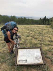
As part of that same trails system, historic pathways such as the Old Spanish Trail and Overland Trail still weave through modern day trails in Colorado. (See the additional resource links and books below.) In fact, my time spent driving over Poncha Pass and hiking through the Cochetopa Creek basin along the Colorado Trail directly connected me to Sangre de Cristo National Heritage Area and the north branch of the Old Spanish Trail. This 19th century trade route spanned the distance between the Mexican provinces of New Mexico and California, using footpaths blazed over centuries by American Indians and reported on by early Spanish explorers. Its heyday existed from 1829-1848, before more southerly roads were pioneered by the Army and the more northerly emigrant trails came into favor. There were three routes that are identified today as the Old Spanish National Historic Trail. The North Branch proceeded north from Santa Fe into Colorado’s San Luis Valley, followed the Saguache River Valley, crossed Cochetopa Pass, and forded the Colorado River near Grand Junction.

Throughout my time on the Colorado Trail, I could envision how previous explorers and Native Americans utilized the same paths that our National Trails system keeps in tact to this day. And I hope that everyone living the trail life can appreciate this important piece of heritage as well.

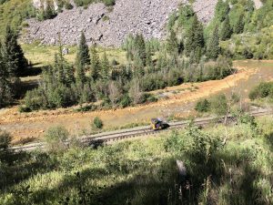
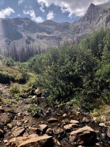
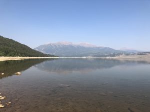
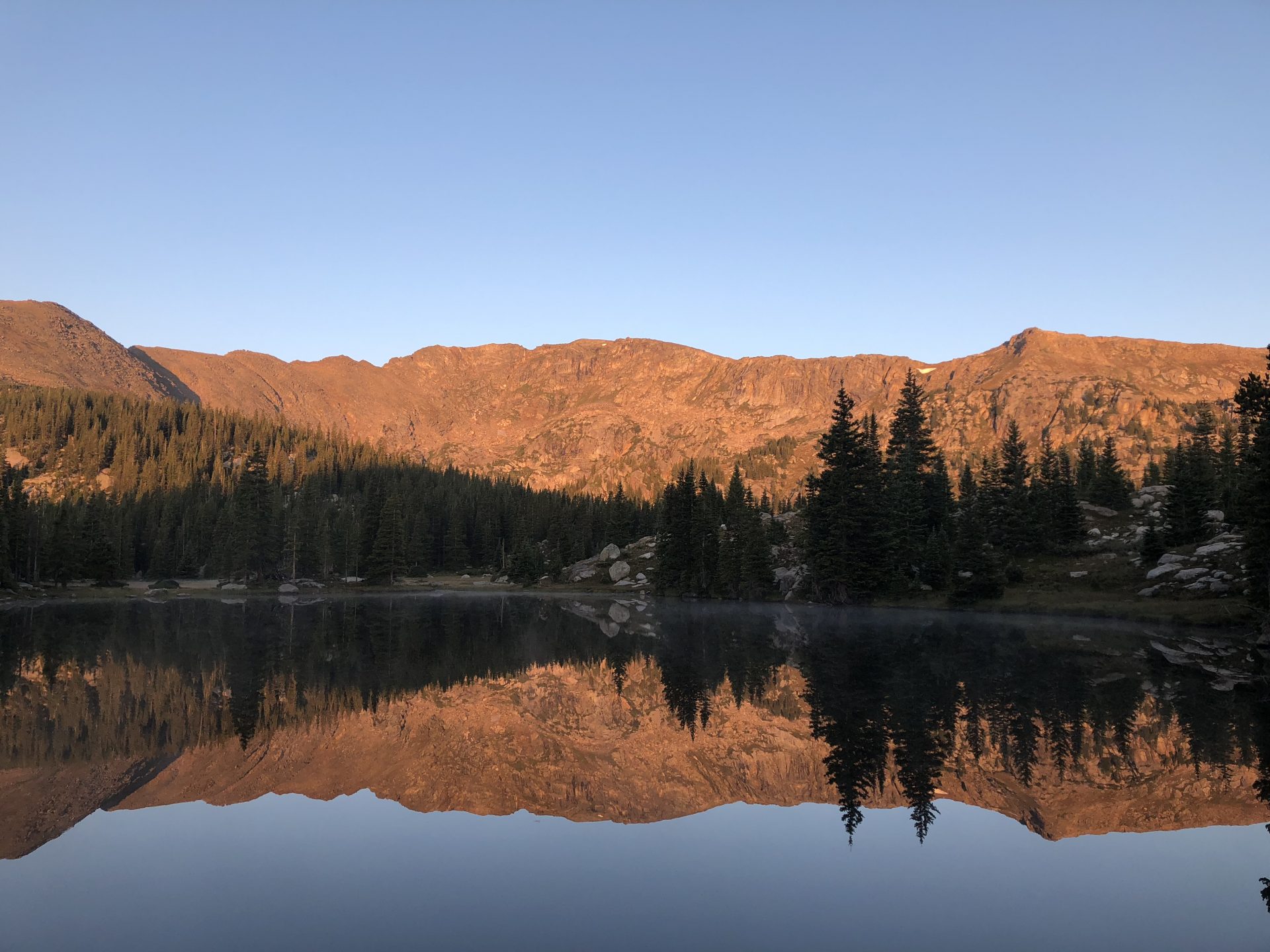
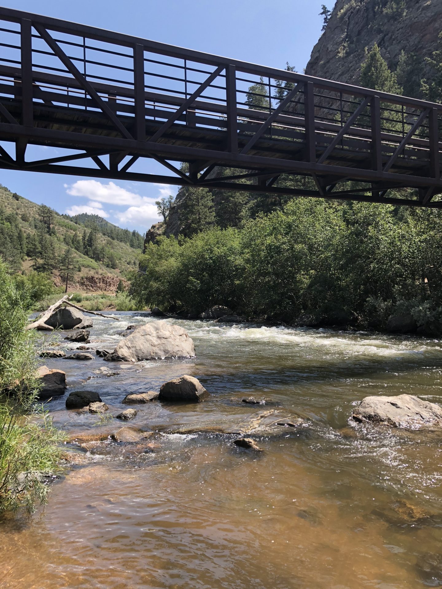
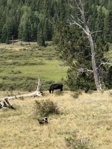
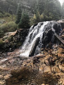
Day 27: After several blue sky days in the San Juan mountains, the weather forecast for the week looked pretty foreboding. We woke up to rain in Silverton, then as we drove away from the town to Molas Pass, we glimpsed snow on the tops of the 13,000 ft mountains in the distance. Yikes. Thankfully on this day we were able to avoid most of the thunderstorms and hail on our way to a beautiful camping spot at Cascade Creek. The roaring river and waterfalls more than made up for the rainy and cloudy conditions. (See the waterfall picture before.) We also avoided contact with another herd of sheep that we only heard from the hillside. Talk about a different trail life than our experience!

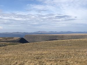
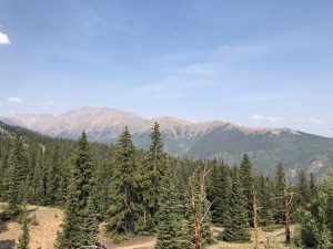
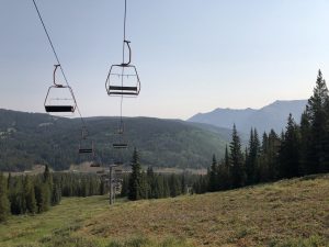
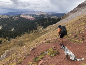
Day 28: With only few days of hiking remaining, we seemed to be grinding out miles faster than usual. It helped that we once again were lucky with weather as the mist and clouds seemed to be building behind us rather than in front. After many days in the wilderness without mountain bikers, we were encountering more cyclists than hikers at this point. Some were camping along the trail as well, while others were just out for a day of joy-riding over Blackhawk Pass and milky colored creeks. (See our picture from the top of the pass below—right before the mountain bikers came speeding by us on the downhill.) At times there can be friction between different trail users, but most of the mountain bikers we encountered during our travels were very respectful of the backcountry.

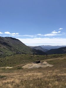
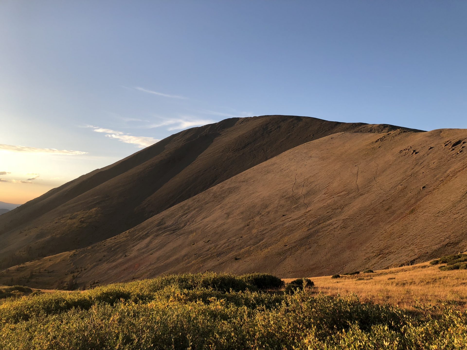
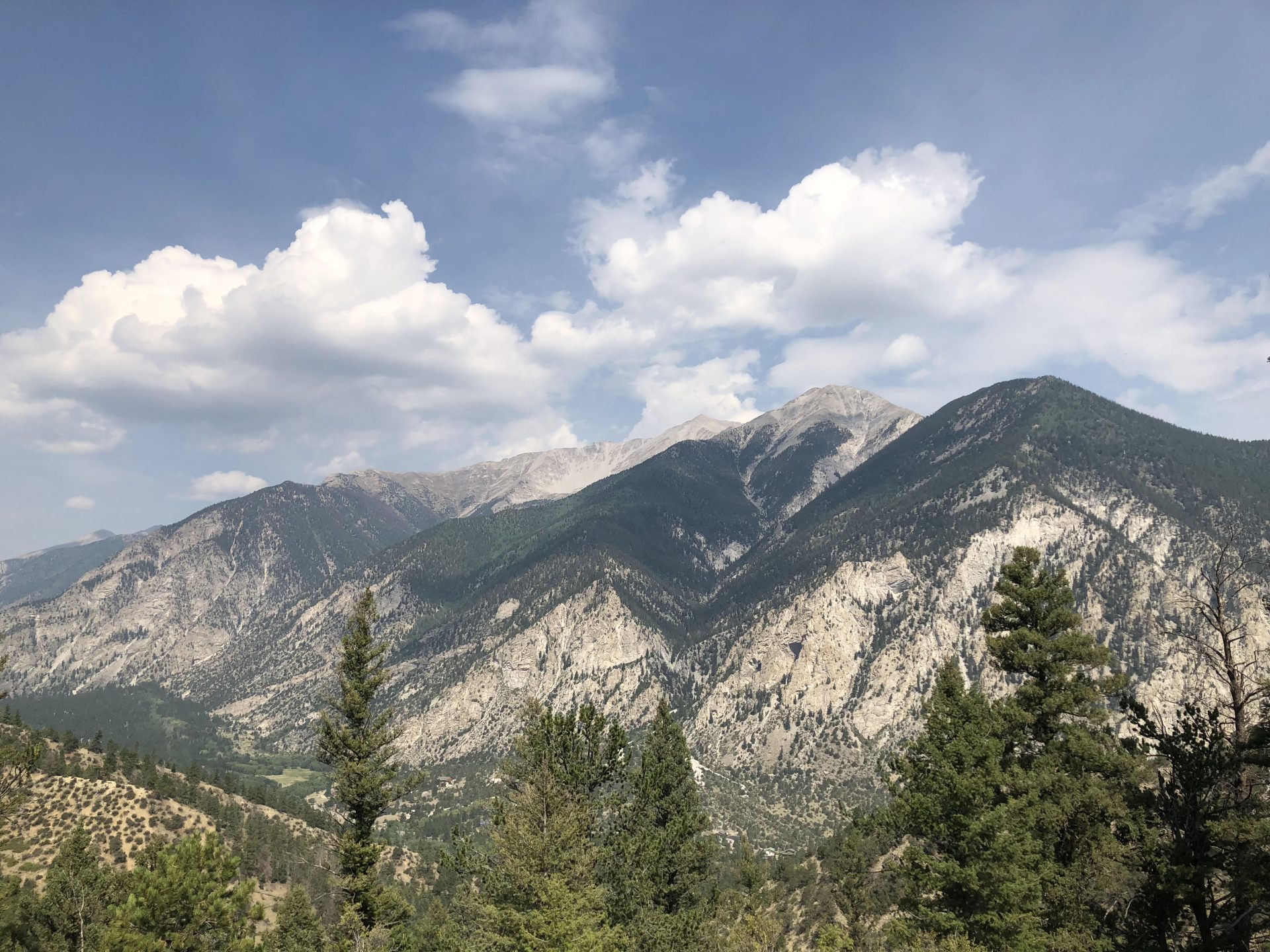
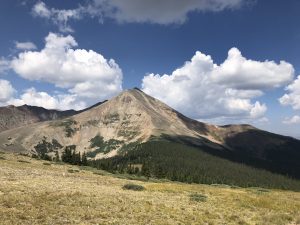
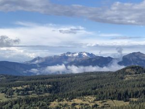
Day 29: From where we were camped at Straight Creek the previous night, we had a stretch of 22 miles before we would run into another water source at Taylor Lake. We were making good time over the déjà vu style up and downs until lunch when the hail and rain finally found us. After 45 minutes of huddling together under our tarp, we made a break for our campsite which was about another four miles down the trail. Despite muddy walking and thunderstorms all around us, we finally made it to our scenic overlook campsite for the evening. The views, clear skies, and sun were quite the treat after all the stressful hiking over the last few days. (See the picture below of the snow-capped mountains in the distance.) Amazingly, despite such an awesome campsite, we didn’t run into any other trail users on this Labor Day.

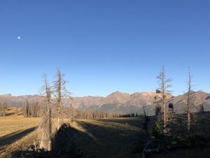
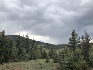
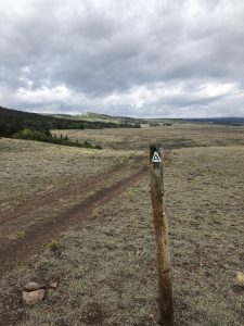
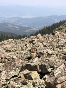
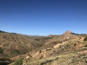
Day 30: With sunny and clear skies in the morning, we prepped for our final big climb over Indian Trail Ridge, also known as the Highline trail, which would take us over 12,000 feet for the final time. The ups and downs were taxing but beautiful as we said goodbye to the alpine views behind us while also glimpsing the forest burn sections that had closed the Colorado Trail earlier in the summer. While the CT was now open, many other trails in this area were still closed because of mudslide and hotspot dangers.

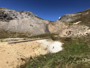
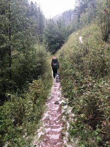
As we made the descent over Kennebec pass, I was able to reminisce about a 12 mile race I did in the La Plata canyon two years ago. But I didn’t have time to dwell on these fond memories, because as soon as we got back into treeline, the hail, thunder, and rain began. Despite our best efforts to wait out the rain, it wouldn’t let up. Eventually, we had to forge ahead through trails that resembled rivers and forests that were covered in a white layer of hail. (See the white-spotted picture below.) Despite a miserably wet campsite, our spirits were lifted when two other thru-hikers who we knew from our earlier travels camped with us that night. Misery really does love company!

Day 31: Now that only 15 miles separated us from Durango and the end of our journey, it didn’t matter as much that our shoes and equipment were soaked. We pressed on through fairly easy hiking conditions, and soon the sun was shining on our final day of hiking the Colorado Trail. After crossing the finish line, we waited for our hiker compadres to reach the trailhead as well so we could give them a standing ovation. Then after our friends who live in Durango picked us all up, we went to the local brewery to receive our free beer for completing the trail. It was the best beer I have ever tasted.

After 31 days of hiking on the Colorado Trail from July 30 to September 5, my biggest takeaway is what I call my new “trail mentality”. Essentially, it boils down to living in the present and enjoying the moment. Another assumption that many people have about the trail life is that there is a lot of time for reflection and introspection. But usually, you are too tired or too focused on the hill in front of you to worry about the world at large. This mentality can be a good thing I think because it directs us to concentrate on the challenges immediately before us (e.g. the uphills), enjoy the fun times when we can (e.g. the flat parts), and not worry about the future outside our own purview (e.g. the inevitable, leg-pounding downhills).

The whirlwind of modern life will undoubtedly infringe on my trail mentality in the not too distant future. But I feel confident knowing that our national trails, wild and scenic rivers, and National Heritage Areas will be there to remind me of the important things in life when I need an escape to the outdoors. Now it’s time to look at my calendar so I can plan my next visit to our trails—maybe next weekend?

  • Recommendations for future readings:
    • For the Old Spanish Trail, particularly regarding Juan Bautista de Anza and his crossing of Poncha Pass:
      • Anza’s 1779 Comanche Campaign by Ron Kessler (original journal)
      • Juan Bautista De Anza the King’s Governor in New Mexico by Carlos R. Herrera
      • The Comanche Empire by Pekka Hamalainen
    • Overland Trail: https://coloradoencyclopedia.org/article/overland-trail

About the author: Jordan Williams is the Assistant Program Manager for the Poudre Heritage Alliance, and he will be hiking 400+ miles of the Colorado Trail from Denver to Durango from August to early September alongside his wife Kelsey and their dog, Aska. During their trip, the threesome will be making stops in South Park and Sangre de Cristo National Heritage Areas and blogging about their experiences. Additionally, they will be posting about their adventures on Instagram @thehikingheeler and @poudreheritage. Don’t miss your chance to learn more about Colorado’s Heritage Journey!

Colorado Heritage Journey: Riding the Railroads

By News

Backpacking in an efficient and relatively comfortable manner requires a considerable amount of “technology”. Basic gear includes a sleeping bag, sleeping pad, rain cover, tent, water filter system, trekking poles, cooking stove, and of course a backpack to carry everything. With all of these items, you could spend hours researching the most cost effective and lightest possible equipment. Hikers can talk equipment tech for hours sometimes.

When I am out on the trail though, the dichotomy between the technology that I am carrying and the technology of the past or present becomes interestingly juxtaposed. For example, we will often be hiking for hours out in the wilderness by ourselves, only to come to a jeep road with an ATV or quad full of people flying past us. When this happens, I can’t help but think—“that sure looks a lot more comfortable than what I am doing”. Other times, I come to an old dilapidated log cabin at 11,000 ft and wonder—“how the heck did people survive up here without a four-season down sleeping bag?”

Nowadays, there are countless ways to explore nature, whether it’s backpacking, mountain biking, climbing, horseback riding, or in an off-road vehicle. All these options require their own know-how and equipment. When you think back to the frontier days of Colorado in the 1800s though, one technological advancement truly opened up the Rocky Mountains to exploration and settlement: the railroads.

I felt this connection to our state’s heritage while walking along the Durango and Silverton Narrow Gauge railway (D&SNG) as it parallels the Colorado Trail. (See featured picture.) If I wanted to, I could have even waited for the next train and skipped a few miles of trail as the train would take us to Silverton for our next resupply. Of course, today this train functions as a tourism connection rather than an industrial necessity for mining and transportation. But back in the day, the railroads were the way to get around.

Starting in 1882, four railroads would be built before 1900 to serve the small mining town of Silverton, Colorado. These lifelines not only made mining lower grade ore profitable, but they provided much needed supplies to the town’s inhabitants. With declining profits from mining in the 1900s, many railroads across the state folded and tore up their tracks for use in other industries. However, the 45.6 mile D&SNG was ultimately saved because of interest from Hollywood and heritage tourism.

The Cache la Poudre River National Heritage Area is no stranger to it’s own technological advancements. With railroads still running through cities like Fort Collins, the heritage area itself was designated in part to commemorate advances in water management systems. For example, the Parshall Flume—a water measuring device used around the world to this day—was invented at the Bellvue Hydraulic Lab, which is connected to the Jackson Ditch in Laporte, CO.

The remnants and histories of other railroad companies and past technologies can be glimpsed at many points along the Colorado Trail. Now every time I see an old mining cabin, a torn up railway, or an ATV flying past me, I can’t help but appreciate the hardiness of the area’s first settlers and an appreciation for human ingenuity. But my last thought is usually gratefulness for my warm sleeping bag, and thankfulness for an automobile that will take me into town when I want to get off the trail.

Day 23: After a leisurely morning in Lake City, we received a ride from the local volunteer shuttle back to the trailhead. Of course, the 3 hour town-wide power outage certainly made the morning interesting. Never a dull moment in a small trail town! Because we were getting back on the trail later than usual, we had a short day planned that would land us at the Colorado Trail Friends Yurt. (See the sunrise picture from the deck of the yurt below.) Rather than sleeping in a tent on the ground, we would get to sleep in a shelter, on a cot, with chairs and a table! Ah, the little things in life. Of course, the over-used outhouse and mice trying to steal our food made for an interesting night’s sleep.

Day 24: While we were a little bummed to leave the yurt, we were excited to reach the highest point on the Colorado Trail at 13,271 ft. This segment promised beautiful views of the San Juan Mountains, and we were not disappointed on this blue sky day. Every few feet, I was tempted to stop and take a picture, which definitely slowed down the hiking. We also finally ran into some wildlife, with the coyotes howling in the Lost Creek basin, moose lounging at Cataract Lake, and marmots chirping at us from everywhere. In addition to this feeling of remoteness, we came upon the old Carson Saddle mining community (see pic below), which now included an abundance of ATVs on its old roads. Living up here must have been quite the challenge back in the day.

Day 25: After waking up to frost on our tent at 12,500 ft, we steeled ourselves for more ups and downs before we would finally leave the Continental Divide at Elk Creek Canyon. We walked past the headwaters of the Rio Grande, which flowed into a trickle down below. Then we proceeded over Stony Pass, which still housed the remnants of an old railroad that climbed over this 12,000 ft mountain. (See pic below.) We had more breathtaking views along the divide in the Weminuche Wildnerness, and then we ran into a huge flock of sheep at the top before we began our descent. That night, we shared our campsite with a couple moose and deer who were having dinner and drinks near our campsite. It was definitely a memorable day to say the least!

Day 26: With the promise of another town stop in Silverton, we hiked hard and fast over the D&SNG Railroad and the Animas River. (See pic below.) The uphill to reach Highway 550 from the canyon was a challenge, but it was nice to be down at lower elevations with more oxygen to breath and more trees to provide shade. We listened to the train go past us from afar, but we were thankfully able to get a quick hitch into Silverton from the road. I have been so appreciative of people’s willingness to help us along our travels from friends and strangers alike.

As I sit in the newly reopened Coffee Bear café in Silverton, which at one time was an old saloon, it’s crazy to think that we only have 75 miles of the trail left until we reach Durango. Undoubtedly, there will be injuries, weather complications, and unforeseen challenges along way the way. But thanks to modern technology, hopefully we will be able to weather the storm (literally and figuratively). In the end though, I will only have more appreciation for Colorado’s heritage that brought us to the mountains via trails, horses, railroads, cars, airplanes, and more.

About the author: Jordan Williams is the Assistant Program Manager for the Poudre Heritage Alliance, and he will be hiking the 400+ miles of the Colorado Trail from Denver to Durango from August to early September alongside his wife Kelsey and their dog, Aska. During their trip, the threesome will be making stops in South Park and Sangre de Cristo National Heritage Areas and blogging about their experiences. Additionally, they will be posting about their adventures on Instagram @thehikingheeler and @poudreheritage. Don’t miss your chance to learn more about Colorado’s Heritage Journey!

Colorado Heritage Journey: Places, People, and Names

By News

I like maps a lot. I have been fascinated by them for as long as I can remember. When I see a map of pretty much anything (especially if it shows mountains and trails), I usually stop to take a look. In planning for our Colorado Trail hike, I have looked at a ton of maps, data books, and digital apps. It seems like exhausting work, but I truly enjoy it. When I see interpretative signs along the trail, I get excited because they usually provide in-depth background information that a basic map does not usually showcase. Sometimes, I just want one simple question answered—why was that thing I am looking at on a map (or in-person) given its name?

It may seem like a basic query, but often there is a significant history behind a name. Other times, with names like Snow Mesa or Lake City, it’s pretty obvious why someone chose that moniker. Along the Colorado Trail however, many places and names keep popping up that mean a lot to the indigenous and local people of the area.

During our last stretch of the trail from Salida to Lake City, I noted one name in particular—San Luis. This name was very familiar to me even before the Colorado Trail, since Sangre de Cristo National Heritage Area includes 3,000 miles of the San Luis Valley. This region includes a wealth of Hispanic and Ute Indian influences, as well as “the oldest town in Colorado”—the town of San Luis in Costilla County. From what I could find online, the Hispanic settlers of San Luis had come from the Taos Valley, and dedicated their new church during the Feast of Saint Louis on June 21, 1851. They would then name their town after their new patron saint. I dug even further, and found out that Saint Louis was a French monarch from the 1200s who is the only king of France to be canonized.

As you peel back the layers of history, the complexity of our natural and cultural heritage becomes evident. After hiking this portion of the Colorado Trail, which included 14,000 ft+ San Luis peak and San Luis pass, I have a new appreciation for those little points on the map which in part recognize a sainted French King. (See featured pic of San Luis peak at sunset.)

Similarly, when discussing the history of the Cache la Poudre River, I have seen other people experience the same enlightenment after learning that the river’s name means cache of powder in French. The tale goes that French fur trappers got stuck in a snowstorm and had to store their gun powder along the river banks so that they could make it out alive. Afterwards, the name seems to have stuck, even though there are alternate accounts from other European settlers and indigenous populations.

For my trip along the Colorado Trail, I will continuously look for these influencers who shaped those maps and defined those points of interest. Meanwhile, Colorado’s National Heritage Areas will help interpret and tell these important stories.

Day 18: After spending a couple extra days in Salida and skipping some drier sections of the trail, we were lucky to receive a ride from a “trail angel” name John, who drove us through the town of Saguache along CO Highway 114. The Spanish word “Saguache” (spelled/pronounced “Sawatch” in English) seems to have several different translations, but it stems from the Ute word meaning “water at the blue earth”. Soon after we started hiking on this section of the trail, rain began falling from the sky and filling the dry creek beds, thereby cementing the appropriateness of the area’s name in hindsight. (See pic below of the clouds that would soon soak us.) It continued to rain throughout the night, which provided an ominous beginning to this section of the trail.

Day 19: Usually, mornings on the Colorado Trail include blue skies and sun. Not this day though (see ominous pic below). We woke to cloudy skies, and were treated to more rain, thunder, and hail later that day. As we entered the La Garita Wilderness, we pushed on to the next trailhead for an accidental 20 mile day while looking for shelter of any kind to dry out ourselves and our equipment. Interestingly enough, “La Garita” means the “the lookout” in Spanish and was given to this area because of San Luis Peak, the wilderness area’s only 14er which can be found looking down on you throughout most of your time in this region. Of course, we could only look out and see more clouds and rain on this day.

Day 20: We awoke with cautious optimism as we finally glimpsed blue skies and the hopes of drying out after two days of wetness. Despite a few early morning clouds, the sky cleared and presented amazing views of the Cochetopa Creek basin, which originates at San Luis peak. (See picture below from the top of the basin.) The Cochetopa hills and mountain pass are integral geographic features in this region, with “Cochetopa” being a Ute Indian word for “pass of the buffalo”. We didn’t see any buffalo of course as we crested the saddle below San Luis peak, but we were greeted to amazing views at 12,600 ft as we made camp that afternoon. The trials and tribulations of the previous days undoubtedly made the superb hiking and beautiful vistas all that much sweeter.

Day 21: It was an early morning as we took a 3 mile detour from the Colorado Trail to hike up San Luis peak. 14ers are always a challenge, but being the only people on the mountain during sunrise was a special experience. Even though it was a shorter day for us in terms of mileage, staying above 11,000 ft while going up, down, up, down, up, and then down again over San Luis Pass was exhausting. Water sources were also troubling, until finally we met up with Middle Mineral Creek (see pic below). As we tasted our filtered water that night, we realized the creek was also correctly named—it was some of the hardest water yet.

Day 22: With the hopes of catching the shuttle to Lake City, we got up early again with only 10 miles separating us from real food and a comfy bed. We said goodbye to the La Garita Wilderness, and hello to several exposed miles along Snow Mesa. (See pic below.) The trail presented countless views of the aptly named “Continental Divide” and the many mountains ahead. On the west side, I could picture all the water running to the Gunnison River, then the Colorado River, then the Pacific Ocean. Then on the east side of the divide, I could envision everything streaming towards the Rio Grande, through the San Luis Valley, and to the Atlantic Ocean.

After a final sharp descent to the trailhead, we were reunited with several other hikers who we had met in passing along this section. We really felt the remoteness of the Colorado Trail through the La Garita Wilderness, but here we all were waiting for a 17 mile ride into town. Thankfully, as the rains rolled in at the trailhead, we were all able to get a hitch into town where we were greeted by a friend with amazing food and great lodging at the Matterhorn Motel.

As we head towards our last 125 miles of the trail, I will continue to look for those historical and cultural connections to the places and people highlighted on all my maps. Whether it’s Hispanic settlers and Ute Indians in the San Luis Valley, or French fur trappers and Northern Arapaho in the Poudre River Valley, Colorado’s National Heritage Areas will continue to tell the stories of the people and places that make up this state’s constantly evolving natural landscapes.

Sources:

https://www.fws.gov/mountain-prairie/refuges/documents/San%20Luis%20Valley%20Complex%20-%20Cultural%20History.pdf

http://www.townofsaguache.org/saguache-past—future.htm

https://www.summitpost.org/la-garita-wilderness/732791

http://sdcnha.org/about-us/

For more information on Ute Indian history, the book “Troubled Trails: The Meeker Affair and the Expulsion of the Utes from Colorado” by Jonas Grant and Robert Siblernagel was recommended to me. For a video series on the Northern Arapaho Tribe in the Poudre River Valley, check out poudreheritage.org/videos.

About the author: Jordan Williams is the Assistant Program Manager for the Poudre Heritage Alliance, and he will be hiking 400+ miles of the Colorado Trail from Denver to Durango from August to early September alongside his wife Kelsey and their dog, Aska. During their trip, the threesome will be making stops in South Park and Sangre de Cristo National Heritage Areas and blogging about their experiences. Additionally, they will be posting about their adventures on Instagram @thehikingheeler and @poudreheritage. Don’t miss your chance to learn more about Colorado’s Heritage Journey!

Colorado Heritage Journey: Mining for Colorado’s History

By News

Hiking the Colorado Trail is the hardest thing I have ever done. The combination of physical and mental challenges is a unique cocktail of adventure beyond my normal trail races and camping experiences. And it’s not just the extreme uphills and bone-crushing downhills that tax your body and mind. The many hours spent wandering through the forests and valleys with little in view except more of the same brings to mind many questions: Why am I doing this? Will things ever get easier? What happens if I just quit?

I feel like the first settlers of the Colorado territory probably felt the same way when they faced numerous challenges of their own. After the first Colorado “Gold Rush” in 1858, many people started streaming into the state hoping to find their fortune. Soon, others discovered that Colorado’s Rocky Mountains were truly a mineral belt of untapped resources. The Colorado Trail, and several of the towns along the way such as Leadville and Silverton, tell this story of how the mining industry shaped the state’s culture and history,

As I reached the Chalk Creek Canyon, just past the Mount Princeton Hot Springs, this history came alive. (See featured picture of Mount Princeton from the opposite side of the canyon.) In the 1880s, St. Elmo became a boom town as the silver and gold mining took off. The railroad brought industry to the area, and soon other minerals were discovered as well. Mount Antero, another 14er looming in front us of at the trailhead, has produced an abundance of aquamarine, topaz, quartz, and crystals over the years. Having walked by many houses on the way to the trailhead at Chalk Creek near Mount Antero, I could picture how this area would have been bustling with mining and railroad activity in the not too distant past.

Of course, water is an integral component to the mining process. So even before the prior appropriation doctrine had been officially established in Colorado’s state constitution of 1876, miners were diverting water for beneficial use in their operations shortly after the 1858 gold rush. Miner’s codes had a significant impact on Colorado’s water law, which would become the standard for many western states as those “first in time” had a “first in right” ability to divert and use their allocation. The Cache la Poudre River National Heritage Area commemorates the importance of the Colorado doctrine as it relates to water law in the west. (For a fuller account of Colorado’s mining history and water law, David Schorr’s book “The Colorado Doctrine” was recommended to me.)

While the obstacles facing those miners and water managers are much different than the mental and physical challenges we face on a daily basis while hiking the Colorado Trail, I would like to think at some point those early settlers must have been thinking the same thing as me—that this is the hardest thing I have ever done.

Day 13 on the trail: We said bye to Twin Lakes after a restful couple days, but we were faced with an immediate conundrum—how do we get back on the trail? We could walk the extra miles around the lake (see picture below), but the easiest way would be to hitch a ride to the east side of the dam and jump on there. Hiking “purists” may scoff at skipping even a couple miles of trail, but one of my favorite things about thru-hiking is the motto “hike your own hike”. This motto really means that your adventure is what you want it to be. Fortunately, we got lucky with some “trail magic” and got a ride with another hiker. It made for a more enjoyable, less stressful start to our third section of the trail.

Day 14: After camping alone in the Collegiate Peaks Wilderness, which was our first solo camping experience for quite some time, I awoke to a mystery—where did one of my socks go? I often hang my socks from a tree or my pack at night to air dry, but this time I was missing one. My pack was even ensconced in my rain cover as usual, but there were a couple odd things going on. One of my rain cover tightening straps was broken, my pack’s side strap was nearly severed, and there were several holes in one of my socks that did make it through the night. There could only be one explanation—squirrel attack! A lot of people ask about wildlife on the trail, but up until this point it had been fairly uneventful, meaning that we hadn’t seen any moose, bears, or mountain lions (thankfully, although we finally did run into some moose—see pic below). However, now I became just as worried about squirrels as anything else. Next time Aska, our dog, goes after a squirrel, I may not be as quick to recall her.

Day 14 on the trail also saw some of our biggest hiking challenges so far, with 1400 ft up, then 1200 ft down, then 1400 ft up, before finishing our 18 mile day with another 1200 ft up in the last 1.5 miles to another lonely camping site above 10,000ft. It was then, in the Collegiate Peaks Wilderness with no one else around except Kelsey, Aska, and I, that I thought—this has to be one of the hardest things I have ever done. (But the views are pretty—see our picture below of the Collegiate Peaks.)

Day 15: With the potential for an easier day ahead after a blistering 2400 ft decline in 2.5 miles out of the Collegiate Peaks Wilderness from Mount Yale, things were looking up. Of course, with easier trails and popular trailheads come more people and sometimes more problems. Between the kids, dogs, and horses on the trail at this point, new challenges presented themselves around every corner—including a broken trekking pole. Just when you think you have the trail figured out, it can throw you a curve ball.

Day 16: We woke early this day with the prospect of brunch at the Mount Princeton Hot Springs resort in mind. Even the several miles of road walking to the resort was worth it so that we could enjoy real coffee, French toast, and bacon. With extra food in our bellies, we pushed past the amazingly beautiful chalk cliffs (see the picture below) to find ourselves all alone again on the trail. That night at camp though, we finally ran into several other colorful thru-hikers with seasoned trail personas such as “Starbuck”, “Mowgli”, and “Crunchy”. Despite our trouble finding a good water source, and some threatening clouds in the distance, the extra camaraderie really helped motivate us for our push to Salida the next day.

Day 17: After a 20 mile day previously, 8 miles to Highway 50 and hopefully a ride to Salida wouldn’t be too taxing. We passed several other 14ers in the distance, including Mount Shivano, and crossed one of the Arkansas rivers’ many forks. I was excited to be back in a “real” river basin yet again. Thankfully, a trail angel named Chuck just happened to be waiting at the trailhead, and immediately offered a ride back to Salida where we would be staying at the hiker-friendly Simple Lodge for a couple extra days to rest up before getting back on the trail. (See pic below of Salida’s riverfront park.)

Between the breweries, restaurants, and riverfront access, Salida has been a great diversion from the trail. Of course, while the Arkansas River makes me miss the Poudre back home (and look forward to the Fort Collins’ whitewater park project and Heritage Trail), the Colorado Trail begins to beckon us once again. Despite some tendinitis, doggie chaffing, mental challenges, and water shortages ahead, we look forward to completing the remaining 200+ miles of our Colorado Heritage Journey. Our stops ahead include the La Garita Wilderness, San Luis Peak, and Lake City—check back in another week hopefully for my fourth update from the Colorado Trail.

About the author: Jordan Williams is the Assistant Program Manager for the Poudre Heritage Alliance, and he will be hiking the 500 mile Colorado Trail from Denver to Durango from August to early September alongside his wife Kelsey and their dog, Aska. During their trip, the threesome will be making stops in South Park and Sangre de Cristo National Heritage Areas and blogging about their experiences. Additionally, they will be posting about their adventures on Instagram @thehikingheeler and @poudreheritage. Don’t miss your chance to learn more about Colorado’s Heritage Journey!

Colorado Heritage Journey: Our Wilderness’ Legacy

By News

Some people enter the wilderness looking for solitude. Some desire an escape from modern civilization and technology. Why do I enjoy hiking along the Colorado Trail, which goes through several wilderness areas and multiple national forests? I wish the answer was simple, but during this last 75 mile section of the trail from Breckenridge to Twin Lakes, I definitely felt an appreciation for our state’s natural and cultural heritage.

As we ascended over mountain passes, crossed railroad tracks, passed by old coker operations, and slept near alpine lakes, I could not help but contemplate humanities place in the wilderness. In 1964, the United States government created a legal definition for wilderness, which gave certain protections to 9.1 million acres of land at that time. Currently, 109.5 million acres of land are included within that wilderness designation.

Back in January 2018, congressman from Colorado introduced the Continental Divide Recreation, Wilderness, and Camp Hale Legacy Act. It would impact nearly 100,000 acres of the White River National Forest by creating three new wilderness areas and enlarging three others. It would also define Camp Hale as a National Historic Landscape, thereby commemorating the the heritage of the 10th Mountain Division, which trained at Camp Hale and helped the United States secure victory during World War II. (See below for my experiences walking along the Colorado Trail through Camp Hale.)

Wilderness areas are directly connected to our National Forests as well, which provide 20% of Americans with a reliable supply of clean, cold drinking water. The Cache la Poudre River’s headwaters originate in Rocky Mountain National Park, but flow through many miles of the Roosevelt National Forest along with the Cache la Poudre Wilderness area. Untangling this intersection of wilderness, forest, and human history is one of the many stories that Colorado’s National Heritage Areas can tell. Read on for my experiences as we traversed our second section of the Colorado trail.

Day 8: Our first day back on the trail after a delightful day off in Frisco saw us tackling 3000+ of elevation gain and decline. Ouch. With heavy packs, we ascended over the Tenmile Range and experienced a strange dichotomy of natural and human landscapes. Around one corner, marmots taunted us with their yipping (see pic below). Then over the crest of the next hill, we glimpsed the top of the Breckenridge ski resort. Camping along Tenmile creek with several other hikers that night was well-deserved to say the least.

Day 9: In the morning, we were back in civilization as the trail traversed Copper Mountain Ski resort (see the chairlifts below). A donut, croissant, and coffee from the impressive Camp Hale Outfitters was a welcome addition to our morning routine. After a few more miles, we found solitude again as we climbed over Searle and Kokomo passes above 12,000 ft. We crossed paths with a several other backpackers who were becoming familiar faces—the human camaraderie while climbing mountains and camping has definitely been a welcome complement to the loneliness of the trail.

Day 10: Is there such thing as an easy day on the Colorado Trail? After 10 days of hiking and analyzing our routes, my answer is no. Between aches and pains, unexpected climbs, and unforgiving descents, the trail always seems to present a challenge. Thankfully, there are usually “distractions” that keep you interested. This day presented an intriguing connection between modern establishments, and our natural heritage. We walked through the remains of Camp Hale (see pictures of the bunkers below) while construction workers seemed to be surveying for an underground gas line in the area. By the end of the day though, we found ourselves in the Holy Cross Wilderness Area, with an amazing camp site adjacent to Porcupine Lake at 11,400 feet. Again, we shared this wilderness experience with several friendly faces who were also experiencing the same physical and natural challenges as us.

Day 11: We woke early to an amazing sunrise (see featured picture), then geared up for our longest day on the trail so far—21 miles that would take us from the Holy Cross Wilderness area through the Mount Massive Wilderness (Colorado’s second highest mountain), to the base of Mount Elbert (Colorado’s tallest mountain). The challenge was both mental and physical yet again, as there were long stretches with nothing in sight but forest and trail. However, the water pump and garbage facilities at the trailhead were a very welcome slice of civilization.

Day 12: Because of our long day prior, we “only” had a 7+ mile walk into our next town stop in Twin Lakes. As the lakes came into sight, anticipation was building for a real day off and amenities such as a shower and a bed. Of course, Twin Lakes is a National Historic District with limited cell phone and internet service. However, the quaint appeal (and proximity to Leadville) certainly make it a worthwhile destination.

Stay tuned for our next stop in Salida, as we traverse the Collegiate Peaks Wilderness and explore more of Colorado’s natural and cultural heritage along the way.

Sources:

https://www.nationalforests.org/our-forests/your-national-forests-magazine/where-the-water-begins
https://polis.house.gov/news/documentsingle.aspx?DocumentID=398559

About the author: Jordan Williams is the Assistant Program Manager for the Poudre Heritage Alliance, and he will be hiking the 500 mile Colorado Trail from Denver to Durango from August to early September alongside his wife Kelsey and their dog, Aska. During their trip, the threesome will be making stops in South Park and Sangre de Cristo National Heritage Areas and blogging about their experiences. Additionally, they will be posting about their adventures on Instagram @thehikingheeler and @poudreheritage. Don’t miss your chance to learn more about Colorado’s Heritage Journey!

Colorado Heritage Journey: South Platte and Beyond

By News

Backpacking along the Colorado Trail definitely makes you appreciate the value of water. Not having access to tap water, a shower, or an ice cold beer for several days really puts the idea of “wilderness” into perspective. Most of our days along the trail, we try to make camp near a water source, and at the end of the first day our goal was the South Platte River (see picture above). This location had particular meaning for me, since throughout segment 1 of the trail, we had been paralleling the South Platte canyon. Having lived in Fort Collins for over 5 years now, the Poudre Canyon has become a home away-from-home, and the confluence of these two great rivers approximately 5 miles east of Greeley marks the edge of the Cache la Poudre River National Heritage Area. Safe to say, after 13 blistering hot miles on day one, the South Platte’s cold waters were exactly what we needed.

Way back on July 5, 1820, Major Stephen Long reached present day Denver where he also got to look upon the South Platte River. However, his first impressions were not as enthusiastic as my feelings during our Colorado Trail thru-hike in 2018. Long had been commissioned to ascend the Platte River and explore the headwaters of the Arkansas and Red Rivers. His expedition followed the Platte River to its South Fork in the mountains, where they discovered and named Long’s Peak. While his group was not successful in finding the headwaters of the Arkansas and Red Rivers, the Long Expedition was the first scientific survey of the region and dramatically increased the country’s geographical knowledge of the West. Of course, with the spring runoff long gone from the rivers of Colorado, Long thought the the region resembled a “Great American Desert” rather than a Fertile Crescent.

Settlers did eventually pour into Colorado’s Front Range, and they formed towns along the area’s waterways. The Union Colony settlement in 1869 (now present day Greeley) at the confluence of the South Platte and the Cache la Poudre River, and their continued perseverance in utilizing the water resources available in the area, is a prime example of how Long’s initial assessment was a little short-sighted. The Cache la Poudre River National Heritage Area is meant to chronicle how the people of Northern Colorado interacted with the natural landscape and the river to have a nationally-significant impact on water law and water management systems. Which just goes to show that in terms of Stephen Long’s findings, first impressions aren’t always the most accurate.

Unfortunately for our “expedition” along the Colorado Trail, not every day would end with a South Platte River-esque water source. The first few days were incredibly dry, but still very eventful. On Day 1, nature was out in full-splendor as we traversed Bear Creek while running into butterflies, berries, and bobcat poop. We even had some fly-bys from a couple hummingbirds and hawks.

After replenishing our water supplies at the South Platte on the morning of Day 2, we prepared to traverse the Buffalo Creek burn area (see pic below). Despite fantastic footing along the trail and some respite at the local firehouse, Kelsey began suffering some serious blister problems. We hoped to end the 16 mile day at Tramway Creek, but unluckily for us there was no way we were going to pump water from that trickle of a stream. So we headed 4 more miles down the trail to Buffalo Creek, where we spent the night alongside another thru-hiker, a nurse from New Mexico who was attempting to complete the trail in just 30 days. Big props!

Day 3 brought cloudier weather—thank heavens! Unfortunately, we had a 2,000+ ft climb up to 10,600 feet in the Lost Creek Wilderness to look forward to. Despite a lack of views from the top, we were rewarded with a couple of Gatorades from two “trail angels” at our campsite that evening. (See picture below for the valley we camped in.) Our troubles continued though when we discovered that our dog Aska was experiencing chaffage from her pack, and our water filter clogged. Back up iodine pills to the rescue! We were really starting to miss that great tasting, Fort Collins tap water at this point…

On Day 4, I woke up with a headache and some queasiness. Maybe a little bit of altitude sickness? We powered through the first 6 miles of the day though to exit the Lost Creek Wilderness, but we had some company from baby birds and cows along the way (see pic below). That night, we camped for the first time totally by ourselves (except for a few cows that decided to sleep at Johnson’s Gulch as well), where we enjoyed the thunder and lightning show from the comfort of our tent.

Day 5 brought us back to civilization as we headed toward to Kenosha pass to meet up with our friends to help us resupply, which included a new water filter. Yay! We also connected with the amazing media crew from Mount Bailey productions to film a segment and do a podcast for South Park National Heritage Area. Look for it on Facebook by the end of the month! Aska was especially interested in the interpretative signage chronicling the railroading and farming heritage of the area. (See pic below.) That night brought the end of our dry spell, as the rain and wind ravaged our campsite. How are we going to do this whole thing again?

Day 6 found us climbing up and over Georgia Pass, while we dodged mountain bikers on this popular segment of the trail. (See 13,000+ Mt. Guyot in the pic below.) We also ran into several other thru-hikers from all over North America, including Toronto, Boston, and Philadelphia. The rocky road on the way down from the pass made several foot baths in the ice cold streams a necessity that evening. Again, the importance of water, this time for feet care.

Finally, on Day 7 we “sprinted” the last 13 miles to Breckenridge while fighting random rain storms, unfortunate uphills, and annoying foot pains. We were greeted with ice coffees by Kelsey’s parents, and proceeded to enjoy showering and drinking from the tap again. As I write this post listening to Tenmile Creek rushing past, I am beginning to get ancy for the trail however. I can only hope to get lucky with future water sources while avoiding those thunderstorms on the high peaks of the continental divide. Either way, I still have a lot to learn about this state’s water heritage.

Look for my next post in a week from Twin Lakes!

Sources for this article:

About the author: Jordan Williams is the Assistant Program Manager for the Poudre Heritage Alliance, and he will be hiking the 500 mile long Colorado Trail from Denver to Durango from August to early September alongside his wife Kelsey and their dog, Aska. During their trip, the threesome will be making stops in South Park and Sangre de Cristo National Heritage Areas and blogging about their experiences. Additionally, they will be posting about their adventures on Instagram @thehikingheeler and @poudreheritage. Don’t miss your chance to learn more about Colorado’s Heritage Journey!

Colorado Heritage Journey – 2018

By News

July 23, 2018 – This summer, visitor and locals can once again visit all three National Heritage Areas by checking out the Colorado Heritage Journey landing page. Along the way, visitors will learn about the history and heritage that ties us all together from a new perspective: Jordan Williams, Assistant Program Manager for the Poudre Heritage Alliance, will be hiking the Colorado Trail from Denver to Durango from August to early September alongside his wife and their dog, Aska. During their trip, the threesome will be making stops in South Park and Sangre de Cristo National Heritage Areas and blogging about their experiences. Additionally, they will be positing about their adventures on Instagram @thehikingheeler and @poudreheritage.

In 2017, the Cache la Poudre River, South Park, and Sangre de Cristo National Heritage Areas created a first-of-its-kind marketing initiative that highlights the importance of heritage tourism—the next big evolution in the $19.7 billion Colorado tourism industry. By teaming up with the Colorado Tourism Office, this campaign by the three Colorado National Heritage Areas showcases the importance of partnerships in leveraging tourism dollars for the benefit of local economies.

A website landing page entitled “Colorado’s Heritage Journey” includes a map that connects out-of-state visitors and locals to all three areas while providing information on the unique recreational and educational opportunities available in each region. Additionally, a hard copy brochure are available at select state welcome centers and local visitor offices, thereby encouraging people to plan a driving tour of all three areas.

Colorado’s National Heritage Areas oversee a wide variety of programs and services that make economic and cultural impacts throughout their regions while receiving a large portion of their funding from the federal government. The NHAs in Colorado collaborate with local governments, county administrations, and federal agencies, including National Parks such as Rocky Mountain and the Great Sand Dunes, as they wisely utilize these federal dollars. Each Colorado Heritage Area receives approximately $300,000 in federal funding and on average they are able to leverage these dollars at a 5 to 1 return on investment. For more information about the individual Heritage Areas, see below.

Cache la Poudre River National Heritage Area (CALA) begins in northern Colorado, where the river flows out of the Rocky Mountains, through the town of Fort Collins and extends east to its confluence with the South Platte River, just east of Greeley. The area commemorates the river’s significant contribution to the development of water law in the western United States, the evolution of the river’s complex water delivery systems and the cultural heritage of the region. From beer tasting at 25+ breweries and bike riding along 45 miles of the Poudre River, to fly fishing and enjoying concerts and western rodeos, there’s a lot to experience here. (www.poudreheritage.org)

South Park National Heritage Area (SPNHA) is in the heart of Colorado. It is here where the past is always present, protecting and promoting its existing historic mining and ranching structures as well its natural resources. It’s less than two hours’ drive from Denver or Colorado Springs, but feels like a journey back in time – to the days of prospectors, trappers and even prehistoric man. In South Park, you can ride horseback, hike in an authentic wilderness area, or fish lakes and rivers all the while enjoying the scenic vistas that include Colorado’s snowcapped 14,000 foot peaks. (www.southparkheritage.org)

Sangre de Cristo National Heritage Area (SdCNHA) is the gateway to southern Colorado and preserves and protects the unique cultural heritage here. This area is rich in history, religion, culture and bio-diversity protecting and promoting the villages and lifestyles of some of America’s earliest Spanish settlements and early railroad communities. It is among the most unique and well-preserved cultural landscapes in the nation, with stunning natural resources. From scenic drives along Los Caminos Antiguos Scenic Byway, fishing on the Conejos River, sledding down the Great Sand Dunes, or visiting the oldest Catholic parish in Colorado, there’s a lot to appreciate and enjoy here. (www.sdcnha.org)

*Photo courtesy of Kelsey Devereaux: Jordan Williams and Aska at Lory State Park