Tag

Poudre River

Just Add Water: Pre-settlement Water, Land, People Relationships in the Poudre River Valley

By Historic Stories

The Poudre River’s recorded history, prior to gold seekers and settlers arriving in the late 1850s and early 1860s, is scarce.  There were fur trappers’ and explorers’ writings of the area, but these were very limited regarding the Poudre River.  It was during this period that the river obtained its name, but the exact reasons and timing are uncertain.  It is generally agreed that fur traders/trappers needed to stash some of their supplies (including gun powder – in French it becomes ‘Cache la Poudre’), for a short time, during the 1820s or 1830s, for some reason, and the river was named for this action. 

As gold seekers and settlers encountered the Poudre River Valley in the mid-1800s, I often wonder what they saw.  We know that the river today is not like the natural stream before it was adapted to support permanent settlement of large numbers of people.   

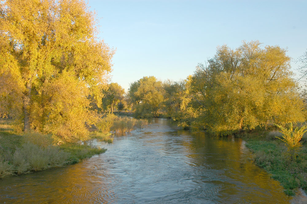
Before permanent settlement in the Poudre River valley, the river meandered in a shallow, braided fashion through the bottomlands.  Each spring, runoff flooded (i.e. ‘irrigated’) the valley bottomlands in such a manner that there was an excellent stand of native grasses growing across the valley floor from the mouth of the canyon to the mouth of the river, east of Greeley.  One place, open to the public, to visualize this low, flat, bottomlands is the Arapaho Bends Natural Area.  As you stand near the remains of the Strauss Cabin, you can gaze across the valley floor (removing Rigden Reservoir from visualization) toward the west and see the bluff with Ziegler Road on top.  Look east to the bluff where I-25 is now located with the town of Timnath on the east side of the interstate.  Looking upstream the valley widens as the Box Elder Creek enters the Poudre River.  Imagine the entire bottomland area covered with native grasses and trees growing along the river meandering through the valley. 

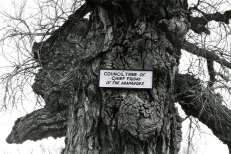
The lushness of grasses drew buffalo into the valley.  It becomes rather obvious why the Native Americans used the area to camp – food, water, fuel – all in abundance.  Just north of the Strauss Cabin, across the railroad tracks, is where the Council Tree was located.  Large numbers of Native Americans could camp in the vicinity to ‘Council’, as the early setters called Native American gatherings, – i.e. transact business, socialize, and conduct ceremonies – while living comfortably on the resources provided by the river. 

This lushness did not escape the attention of earlier settlers to the area.  George Strauss (1858) and Benjamin Eaton (1859), traveling through the area on other missions, noted the lushness and both returned to settle in the valley when their missions were completed.  The Coy family decided to over-winter in the valley on their way to California in 1862, but did not continue their trip when spring arrived.  The Valley is a beautiful place where many people, over the years, have chosen to settle. 

The Northern Arapaho, under the leadership of ‘Chief’ Friday, were the last band of Native Americans to live/visit the Poudre River Valley, being forced out in the late 1860s.  Before leaving, they requested a reservation on the north bank of the Poudre River, on which to live, but were denied.  Friday’s band eventually was assigned to live on the Wind River Indian Reservation in central Wyoming. 


References:

Silkensen, G. 1993. South Platte River Observations: Historical Clues to the Evolution of a River’s Ecology. Published in the Proceedings of the 1992 South Platte Conference, Information Series Number 72, Colorado Water Institute, Colorado State University, pages 41-56. http://www.cwi.colostate.edu/publications/IS/72.pdf

Simmons, Marc. 2004. Friday: the Arapaho Boy – a Story from History. Children of the West Series, University of New Mexico Press, Albuquerque. 

Burris, Lucy. 2006. People of the Poudre: An Ethnohistory of the Cache la Poudre River National Heritage Area, AD 1500-1880. (Published through a cooperative agreement between the National Park Service, Friends of the Poudre, and the Cache la Poudre River National Heritage Area)
Just Add Water: Why is there a National Heritage Area associated with the Cache la Poudre River?

By Stories

The main answer to this question is WATER!  The Poudre River’s water history is not unique in the western U.S. – many western rivers have similar stories about human attempts to survive in arid and semi-arid western river valleys.

What makes the Cache la Poudre River worthy of designation as a National Heritage Area is the manner in which its water history is interwoven into the broader fabric of western water law and technology.  The Poudre River’s history, in many ways, is an illustrative microcosm of western settlement that captures the essence of the struggles people faced in living in the dryness that defines the West and, in particular, how they adapted to survive, and thrive, in the dry landscape.  And further, the Poudre’s history shows how people continue, to this day, to adapt to new challenges, such as improving the ecological health of the river and providing for recreation on, and in, the river.       

As historian David McCullough notes:

History is the story of people. 

Water history in the Poudre River valley is no exception.  The series of stories that follow explains the role of the people of the Poudre in establishing western water law, water development strategies, new water management technology, and initial recognition of the need to create a sustainable relationship with the limited water environment that exists in much of the West.  Again, this need continues today as the population of the Poudre Valley continues to grow rapidly. 

The people did not set out to establish new water law, create new technology to manage water, or determine how to divide the limited waters of western rivers.  They set out to survive in a dry and harsh climate. As the people of the Poudre adapted to the dry climate, their efforts were innovative enough to be of assistance and use to other western States and many foreign countries. 

Organizing and presenting a large sweep of western water history, if even in only one valley, can be daunting if the presentation focuses on each discipline’s (i.e. law, engineering, agriculture, etc.) evolutionary path.  The approach used here will chronologically follow the people of the Poudre, explain the water challenges they faced in their day, and describe the manner in which they solved each challenge.  The solutions they created for each challenge, when combined over time, will help to explain how we arrived, collectively, at the system of western water management in use today and why there is a National Heritage Area associated with the Poudre River. 

Water history in the West is, in very general terms, about subsistence in the 1800s (the frontier was deemed ‘closed’ in 1890), development in the 1900s (the Bureau of Reclamation was created in 1902 and is now managing 180 projects), and sustainability as the 21st Century dawns (as ecosystem health, instream flows and recreational uses are debated, acknowledged, and incorporated into water law).  This overarching framework provides a background against which the people of the Poudre lived their lives and confronted water challenges facing each generation. 

Read the first story.  


References:

‘The Story of People’

National Park Service. 1990. Resource Assessment: Proposed Cache la Poudre River National Heritage Corridor. Prepared by the NPS Rocky Mountain Regional Office at the request of the City of Fort Collins, December  [Appendix B of this report is entitled: Historical Context – The History of Water Law and Water Development in the Cache la Poudre River Basin and the Rocky Mountain West]  Report can be accessed at:  https://archive.org/details/resourceassessme00nati

Information Source: These stories were prepared by Robert C. Ward, a professor and administrator at Colorado State University for 35 years, to assist in training volunteers on the history behind designation of the Poudre River as a National Heritage Area. [In particular, the information permits water history-related sites along the Poudre River to be explained through the lives of people who adapted their use of water to match the semi-arid nature of the landscape.]

Just Add Water: What is a National Heritage Area?

By Stories

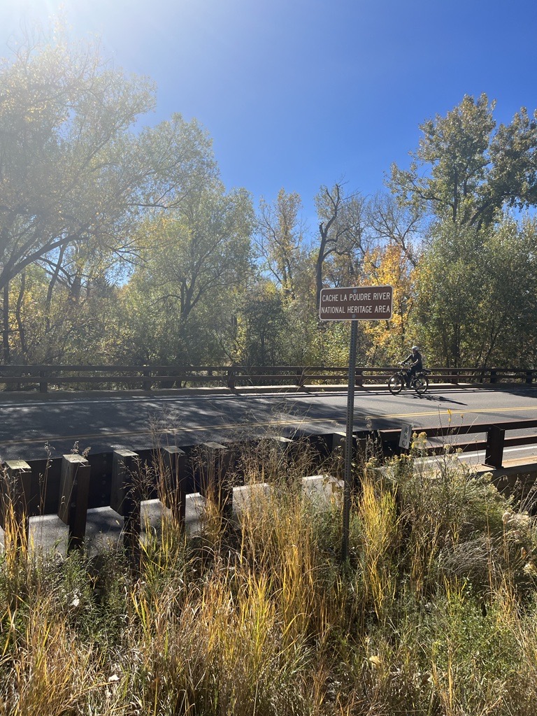
We see signs announcing the Cache la Poudre National Heritage Area when we drive across bridges over the Poudre River and along the Poudre Trail by irrigation ditches.  What is a national heritage area?  Why is there one along the Poudre River?  What does the heritage area encompass?

First, let’s define a National Heritage Area.  According to the National Park Service, that oversees National Heritage Areas:

National Heritage Areas are places where historic, cultural, and natural resources combine to form cohesive, nationally important landscapes.  Unlike national parks, National Heritage Areas are large lived-in landscapes. Consequently, National Heritage Area entities collaborate with communities to determine how to make heritage relevant to local interests and needs. 

In 1984, the first National Heritage Area, Illinois and Michigan Canal National Heritage Area, was signed into law by President Ronald Reagan. In his dedication speech, Reagan referred to National Heritage Areas as “a new kind of national park” that married heritage conservation, recreation, and economic development.

National Park Service. 1990. Proposed Cache la Poudre River National Heritage Corridor: Resource Assessment.

The Cache la Poudre landscape was examined by the National Park Service, in 1990, for consideration as a National Heritage Corridor.  This study was requested by Fort Collins and considered only that portion of the Poudre near Fort Collins.  The recommendations of the study suggested a broader definition of the area covered and, eventually, led to Congress, under the leadership of Senator Hank Brown, establishing the Cache la Poudre River National Heritage Corridor in 1996. 

Implementation of the legislation ran into problems regarding who appointed the Board to oversee the Heritage Area. This problem was not corrected by Congress until 2009.  A Management Plan was prepared in 2013 and the Cache la Poudre River National Heritage Area became a fully funded, and, thus, functioning, National Heritage Area at that time. 

The Cache la Poudre River National Heritage Area’s ‘landscape’ includes the 100-year flood plain of the river from, roughly, the mouth of the Poudre River Canyon, northwest of Bellvue, to the mouth of the river, east of Greeley.   National Heritage Area designation does not affect private property rights. 

References:

National Park Service. 1990. Proposed Cache la Poudre River National Heritage Corridor: Resource Assessment.  Study funded by City of Fort Collins. (https://archive.org/details/resourceassessme00nati) [Appendix B of this document is an excellent overview of the water history behind establishment of the Cache la Poudre River National Heritage Area.]

National Park Service

Information Source: These stories were prepared by Robert C. Ward, a professor and administrator at Colorado State University for 35 years, to assist in training volunteers on the history behind designation of the Poudre River as a National Heritage Area. [In particular, the information permits water history-related sites along the Poudre River to be explained through the lives of people who adapted their use of water to match the semi-arid nature of the landscape.]

Support Poudre Heritage Alliance on Colorado Gives Day!

By News

There are two weeks left until Colorado Gives Day! This state-wide day of giving on Dec. 8th unites all Coloradans in a common goal to strengthen the state’s nonprofits by giving to their favorite charities online.

Help the Poudre Heritage Alliance reach our goal of raising $2,000 in 24 hours to support programs that PROMOTE historical opportunities, ENGAGE people with the Poudre River & INSPIRE stewardship!

Colorado Gives Day features a $1 Million Incentive Fund, created by Community First Foundation and FirstBank. It is one of the largest gives-day incentive funds in the country.

Every donation made through ColoradoGives.org on Colorado Gives Day is boosted by the fund, which increases the value of every dollar. For example, if a nonprofit organization receives 10 percent of the total donations made on Colorado Gives Day, that same nonprofit receives 10 percent of the $1 Million Incentive Fund.

To schedule your Colorado Gives Day donation for PHA today visit: www.coloradogives.org/PoudreHeritageAlliance/overview

Virtual Poudre Pour Happy Hour – Sept. 25

By News

The Poudre Heritage Alliance (PHA) is hosting a virtual Poudre Pour Happy Hour – an educational celebration of the Cache la Poudre River – on Friday, September 25, 2020 from 4:00-6:00PM. The event will feature live stream music from Blues musician Grace Kuch, “Meet the Brewer” breakout rooms hosted by Horse & Dragon, Purpose Brewing, Timnath Beerwerks and Odell Brewing Co., infused appetizers to-go from Z Catering, a silent auction supporting PHA programs, guest speakers, giveaways, and more! Event information and FREE tickets at https://www.eventbrite.com/e/virtual-poudre-pour-happy-hour-tickets-117676819535

Water from the Poudre River has nourished our region for centuries. Today, the Poudre and other rivers in the West are under exceptional stress due to growing populations, drought, and other demands on our water supplies. The Poudre Heritage Alliance raises awareness about water issues and connects people to their water heritage through a variety of year-round programs and events such as the Poudre Pour.

“We care deeply about the Poudre River. I grew up playing in and on it, and only in adulthood came to realize how much we and downstream neighbors rely on its abundance and health,” Said Carol Cochran, owner of Horse & Dragon Brewing Company. “For our product, delicious craft beer, a healthy watershed is vital.  For all of us in our community, this beautiful river is at the root of what drew us here and is the thread that connects us all.”

All proceeds from the virtual happy hour event will benefit the Poudre Heritage Alliance, the 501(c)3 managing nonprofit of the Cache la Poudre River National Heritage Area. The Poudre Heritage Alliance works to PROMOTE a variety of historical and cultural opportunities, ENGAGE people in their river corridor and INSPIRE learning, preservation, and stewardship. To view the silent auction and place your bids visit: https://www.32auctions.com/poudrehappyhour2020 

The PHA’s 3rd Annual Poudre Pour was scheduled for March 28, 2020 but, due to COVID-19, had to be cancelled. The PHA staff and board hope to continue the momentum around the in-person Poudre Pour event with this virtual happy hour, bringing together community members from around Northern Colorado to celebrate our shared Poudre River heritage. The next in-person Poudre Pour is scheduled for Saturday, September 25, 2021 at Boardwalk Park in Windsor, CO.

Poudre RiverFest Going Virtual – Aug 24-29, 2020

By News

Join us for the VIRTUAL Poudre RiverFest!

You’re invited to virtually experience and celebrate the Cache la Poudre River during the Poudre RiverFest starting Monday, August 24th thru Saturday, August 29th. This six-day event will feature a variety of programming including Family Fun activities, Lunch and Learn sessions, Explore the Poudre River content and streamed Live Entertainment every day.

Poudre RiverFest is a free, family-friendly festival that celebrates the Poudre River, promotes restoration, and educates people about our river corridor, an important natural resource in our community. The festival features hands-on activities for children and adults to explore the role of the river as an important habitat for wildlife, a lively recreation area, and a source for clean drinking water.

Visit our virtual programming to create your own customized Poudre RiverFest calendar.

Proceeds from the Poudre RiverFest go to support restoration projects on the Cache la Poudre River. Join us in our restoration mission by donating today!


Festival organizers include:

New Heritage Trail Connects Sites Throughout the Cache la Poudre River National Heritage Area, Starting with Poudre River Whitewater Park

By News

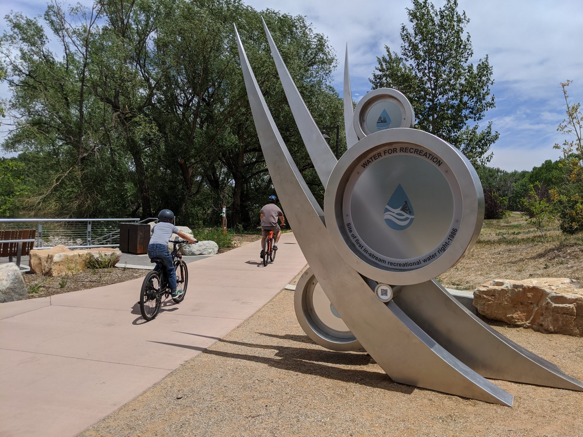
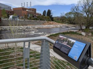
(Pictured: Bikers on the Poudre River Trail ride past the new Heritage Trail Gateway located at the Poudre River Whitewater Park in Fort Collins, Colorado.)

The Poudre Heritage Alliance (PHA), managing nonprofit of the Cache la Poudre River National Heritage Area (CALA), is excited to announce the recent installation of the first marker and gateway of their new Heritage Trail. The marker and gateway are located at the Poudre River Whitewater Park in Old Town Fort Collins.

The Heritage Trail incorporates a coordinated family of interpretive signs, markers and gateways that will be used throughout the Cache la Poudre River National Heritage Area, drawing attention to and educating trail users about interesting and ingenious ways that humans have interacted and worked with the Poudre River to improve life on the high plains of Colorado. The Heritage Trail will highlight six main themes related to water and the Poudre River: Water for Agriculture, Water for Industry, Water for Recreation, Water for History, Water for Education, and Water for Nature.

The Heritage Trail program will also serve to connect town sites and neighborhoods, businesses, historic structures, natural areas, and recreational opportunities, such as the Whitewater Park, that are within or adjacent to the Cache la Poudre River National Heritage Area. The CALA extends 45 miles through Larimer and Weld counties, and through towns and cities such as Bellvue, Fort Collins, Windsor, Timnath and Greeley.

poudre whitewater park

The new Heritage Trail marker at the whitewater park speaks to the history of the Coy Ditch and Diversion Structure and how it relates to water for agriculture, recreation and industry.

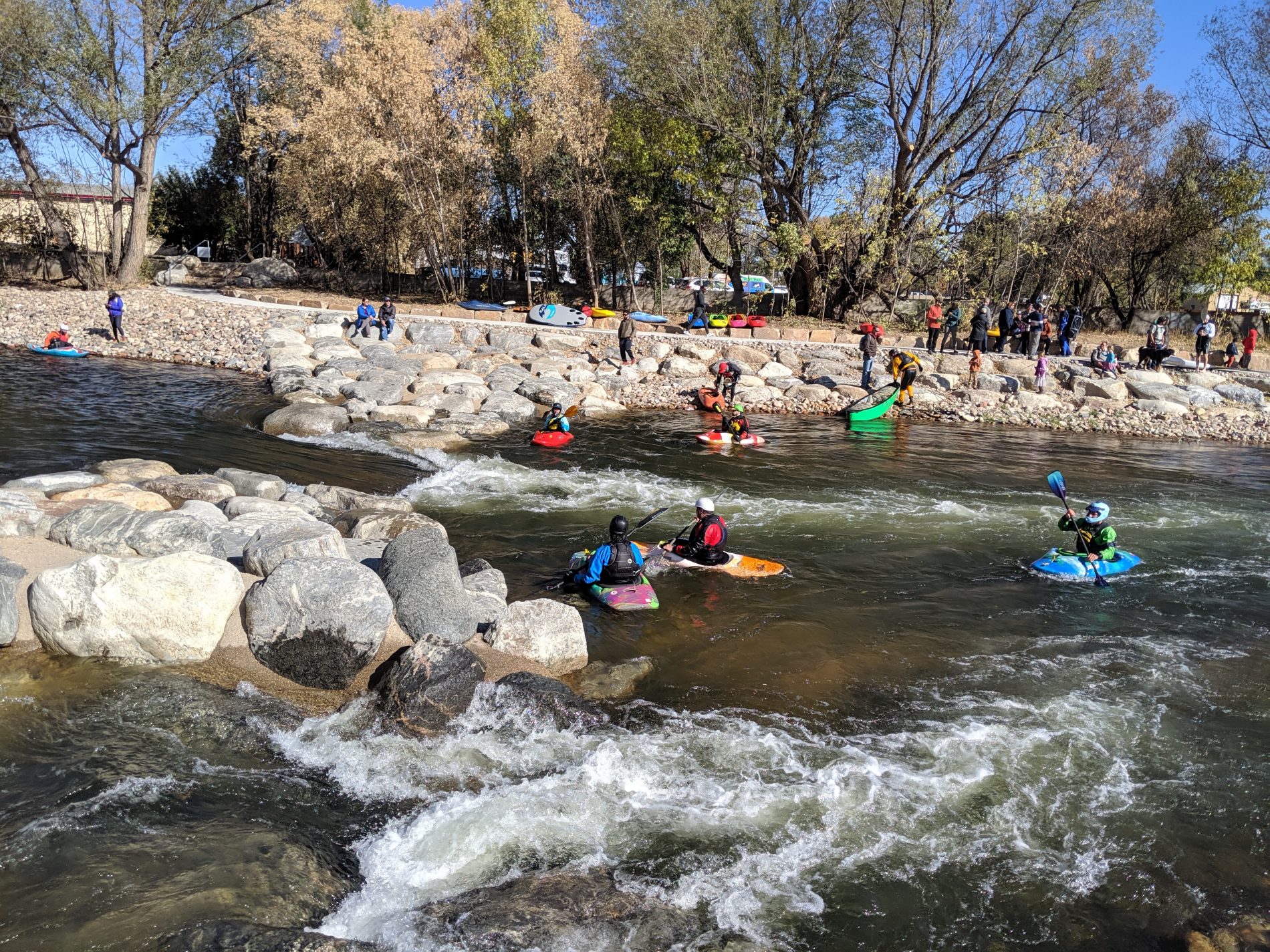
This first Heritage Trail marker and gateway, located at the Poudre River Whitewater Park, speak to the history and importance of the Coy Ditch headgate and diversion structure, which led to the first in-channel water right in Colorado. This type of water right supports “in-channel” river recreation, such as kayaking, as a beneficial use within Colorado’s Doctrine of Prior Appropriations. The site is also important to the history of Water for Agriculture and Water for Industry, with the CSU Powerhouse overlooking the park and the Coy headgate still intact. The marker and gateway include QR codes connecting visitors to additional online resources about these sites.

The Poudre Heritage Alliance worked closely with the Downtown Development Authority (DDA), who helped to fund the project as part of their 5-year investment plan (2016-2020). In addition, PHA worked with the City of Fort Collins Parks & Planning and Art in Public Places (APP) departments to design and install this first Heritage Trail Gateway (located on the south side of the bridge across from the wave shelter) and second, smaller informational marker (located on the north side of the bridge).

Guest Blog: PHA Grant Helps Give UNC Students Practical Skills & Experience in Water Quality Monitoring

By News

by Alexi Richmond, UNC Undergraduate in Earth Sciences (Class of 2020)

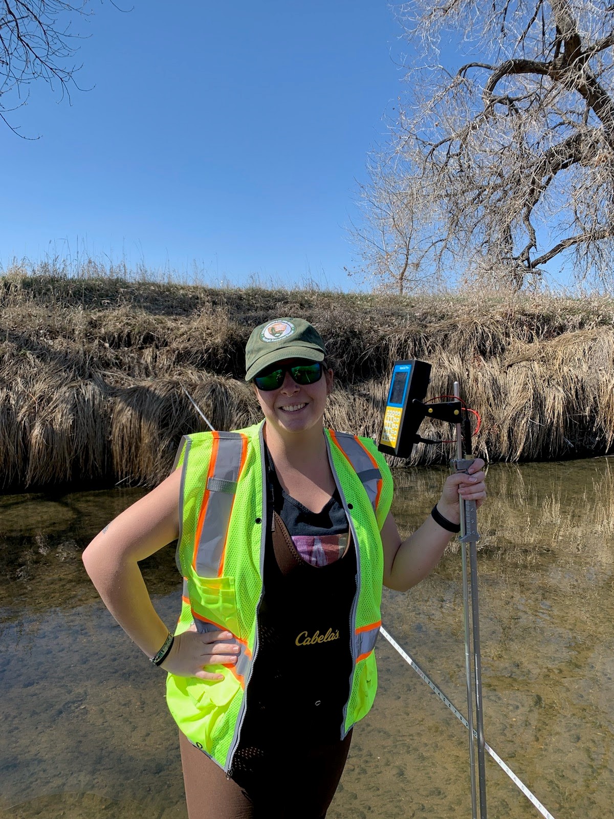
The opportunity to do field work in an undergrad degree is varied and not many students get to assist in research or field work unless it is a requirement of a class. I have been really fortunate to assist my professor this past year and help set up a baseline analysis for future long-term monitoring of the Poudre River in Greeley.

Through this I have learned more skills/practical experience than my whole undergraduate degree combined. I’ve gotten to use devices I never even thought of using such as an GPS, RTK, Flow Meter and of course processing data with Excel. I didn’t realize there was equipment that could calculate such things as measuring cross sections in not only latitude and longitude but as well as elevation so we could see a horizontal view. I also didn’t realize there was such a thing as a flow meter in which it measures the discharge of water; an entire volume of water that moves every second! In class, we had calculated relative discharge with a ping pong ball and a stopwatch and at the time I thought that was just how you took measurements but using the flow meter was a whole other story. It is so much more accurate and it calculates discharge for you which is amazing. It gave me a different perspective on water movement and I feel seeing and doing it first hand I understand the importance of the Poudre River better with how much discharge is even at low flow times.

Throughout this entire project I have come to better understand my local river system and its importance to Northern Colorado. Using equipment has also given me a new perspective through finding how much fun and important collecting data on major rivers can be; possibly giving me a new direction with my degree. I can’t express how grateful I feel to be able to gain skills and experience using real equipment while being able to participate in research, all in my undergrad degree.

River Bluffs Open Space in Windsor, CO is one of the study sites for the UNC Water Quality Monitoring Project on the Poudre River.


About the PHA Grant – “UNC Water Quality Monitoring Project”

The lower Poudre River has experienced long-term channel changes associated with land-use practices and flow regulation. At River Bluffs Open Space, Larimer County has partnered with the Coalition for the Poudre River Watershed to hire Stillwater Sciences to restore a 5 km section of river reach. Goals include reconnecting the river with its floodplain and increasing disturbance, good for habitat development. At the Poudre Learning Center (PLC), the PLC has acquisitioned new land adjacent to the river. The PLC plans to use the property for research, education, outreach, and as community open space. PI and collaborators have installed water-quality monitoring equipment, including turbidity that measures water clarity―a proxy for fine sediment suspension―at each site. Comparing the dynamics of fine-sediment at these two sites provides the opportunity to link information about how two contrasting stream reaches are changing through time as a result of differential influences.

The project takes place at River Bluffs Open Space (Larimer County) and the Poudre Learning Center (Weld County). Fine-sediment dynamics influence channel adjustments that can cause flooding or harm aquatic habitat, and is therefore considered a pollutant under the US Clean Water Act. Project goals include 1) training students in water quality measurements and analysis; 2) establishing long-term monitoring stations at two contrasting Poudre River reaches; 3) using water-quality data to understand dynamics of fine sediment; 4) sharing data and results with stakeholders and the community to increase awareness of linkages between land-use/management and river health. This project contributes to PHA’s vision of placing our water management heritage in the context of current management challenges, including multiple stakeholders and uses.

To learn more about the Poudre Heritage Alliance Grant Program and grant award history please visit: https://poudreheritage.org/grant-award-history/

Play It Safe on the Poudre River!

By News

As the Colorado snowpack starts to melt and rivers and streams across the state begin to rise, its important to remember to Play It Safe on the Poudre!

The Cache la Poudre River offers many miles of incredible recreational opportunities – the scenic river runs from mild (class I-II) to wild (class V), attracting people from around the country to its beautiful waters. However, most people do not understand the dangers that exist while recreating on the river.

The Poudre River presents numerous hazards. Broken or low-hanging tree branches, hidden beneath the water, can snag a person out for a lazy afternoon tubing trip. Freezing waters made cold by spring runoff can cause a person to react slowly, when quicker action is needed, or possibly suffer hypothermia. And deceptively fast-moving waters pose a drowning risk to even the most experienced swimmers.

“The Poudre River is a source of local pride that draws thousands to its waters each year. We wouldn’t dissuade peoples’ love for it and what it represents. But the river is equal parts beautiful and destructive. Its power is easy to underestimate, and river-related tragedy can befall anyone at any time,” said former Poudre Fire Authority spokeswoman Madeline Noblett.

The Play It Safe on the Poudre program raises awareness about approaches to recreating on the river in safe and sustainable ways, and helps to build the capacity of the Poudre Fire Authority and Larimer County rescue teams. The program also calls attention to the history of in-river structures that represent hazards to recreation.


Play It Safe on the Poudre principles:

  1. Wear a life vest
    • Use proper floatation devices
    • Wear shoes
    • Wear a helmet
    • Don’t tie anything to yourself or your tubes
  2. Safe to go?
    • Know the weather and water conditions
    • The water is melted snow – it’s always cold!
    • Avoid rocks, branches, logs and debris in the river
  3. Know where you are
    • Take a map
    • Plan your take-out location before you get in the river
  4. Float sober, float safe
    • Alcohol and drugs impair judgement
  5. Be Courteous
    • Pack it in; Pack it out
    • Share the river
  6. What if you flip?
    • Don’t stand up in the river; avoid foot entrapment
    • Float on your back with feet pointing downstream and toes out of the water
    • Use your arms to paddle to shore


Download a River Access and Safety Map
Other representatives who have taken part in the group’s efforts represent: Poudre Fire Authority; multiple departments within the City of Fort Collins, including the city’s Natural Areas Department; Larimer County; the Larimer County Sheriff’s Office and Larimer County Emergency Services; Colorado Parks and Wildlife, and more.

For more info please visit www.poudreheritage.org/playitsafe