Tag

National Heritage Areas

Funding Opportunities with Cache la Poudre River National Heritage Area

By Uncategorized

Each year the Cache NHA provides funding to local and regional partners in support of projects, programs, and events that benefit the community and further the mission of Cache NHA to promote a variety of historical and cultural opportunities, engage people in the river corridor, and inspire learning, preservation, and stewardship. There are multiple funding opportunities available including Heritage Area Events Grants, Community Projects Grants, and Pass Through and Collaborative Funding Opportunities.

Read More

1874 Water Wars: Was there really almost a pitchfork fight over water 150 years ago?

By Historic Stories, Stories

150 years ago, on July 15, 1874, the conflict over water availability in the Cache la Poudre River Valley erupted. But where did the conflict begin, and why was the river so contentious? Let’s step back in time and find out…

People have been using the water in the Poudre for far longer than 150 years. The Arapaho, Ute, and Cheyenne peoples, along with others, and their ancestors, lived beside and used the Poudre for thousands of years before Euro-American settlement. However, around 150 years ago the way humans used this river, and its water, drastically changed.

While Colorado was not among the first areas to see settlement, by the late 1850s-1860s, the region saw rapid transformation. Spurred in part by the discovery of gold in Colorado in 1859, many people from eastern states like Illinois, Ohio, Missouri, Pennsylvania, and Tennessee moved to Colorado. While some tried to strike it rich, the majority were farmers, feeding the steady market for hay, grains, and fresh produce. Moving from states with significant rainfall (on average 45 inches of precipitation) they initially struggled with Colorado’s dry climate (average precipitation of about 15 inches), before realizing irrigation was the key to success—beginning small scale irrigation ditch building efforts in the 1860s.*

In 1870, 144 families traveled westward on the railroad to create an agricultural community called Union Colony (now Greeley). In need of water, the settlers quickly constructed two working irrigation ditches.

View of Greeley Main Street and Number 3 Ditch in June 1870.
Photo Credit: [1971.20.0004] City of Greeley Museums

The Greeley Number 3 supplied water to kitchens, gardens, and backyards. The Greeley Number 2 to water farmers’ crops. (The Number 1 was never constructed). Union Colony flourished drawing more settlers to the Poudre region. Two years later, Agricultural Colony (now Fort Collins), was firmly established upriver.

Which brings us back to the year of conflict –

In an already dry and arid region, the drought in July 1874 brought a grave threat to the people of Union Colony. Reliant on the Poudre River for water to irrigate their crops and gardens, and to meet community needs, farmers woke up one morning to find the Poudre bone dry at the Greeley Number 3 irrigation ditch headgate.** But what had caused their water supply to completely disappear?

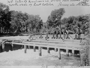
Photograph of the Larimer County Ditch ten miles northwest of Fort Collins. Left to right: Teele, R.Q. Tenney, and Riddle. c1911
Photo Credit: Archive at Fort Collins Museum of Discovery. [H07772]

It was discovered that their upstream neighbors at Agricultural Colony and other upstream locations were diverting what little water was available into their own irrigation canals. New upstream irrigation canals, such as the Lake Canal, had the capacity to divert the whole of the Poudre River, and that wasn’t even accounting for the low flow of 1874, a drought year. Capacity had become reality—the newer canals were diverting much of the river’s flow, leaving little for downstream users. Union Colony was outraged, marching to Agricultural Colony with their pitchforks (yes, this really happened) to demand their water back.

To avoid an all-out war, some forty irrigators met at the Eaton schoolhouse on July 15, 1874, to find a solution. “The evening was hot, the structure was small, and the Greeleyites (among them several Civil War veterans) arrived with their guns” (Hobbs & Welsh, 2020).

Fortunately, guns stayed in their holsters and no punches (or pitchforks) were thrown. The injection of Nathan Meeker, Union Colony founder, warned that failure to reach an agreement river water usage could open the floor to allow “a heavy capitalist or corporation” to build ” a huge canal from the Poudre above La Porte [upstream of both colonies] and run it [all the river’s waters] through the Box Elder country” (Hobbs & Welsh, 2020).

Afraid of this outcome, the group laid down their pitchforks and eventually, after many more hours of loud disagreement, came to a compromise. This compromise became the basis of what is known as Western Water Law and the notion of “First in Time, First in Right,” or prior appropriation, still used across Colorado today. Prior appropriation means each irrigation diversion has a priority number—based upon the date they were built and first began to divert (kind of like take a number and get in line). The senior priority users get first use of the water and down the line. However, they can only divert as much water as they hold shares to and must put it to “beneficial use.” The water provisions established 150 years ago, here in the Cache la Poudre River National Heritage Area, were eventually written into Colorado’s Constitution and are still in effect today.

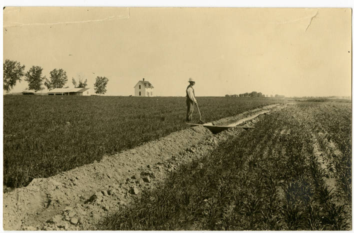
Back of photo reads “Young wheat just starting being irrigated for the first time–Jackburn Baxter.” c1895
Photo Credit: [AI-2526] City of Greeley Museums

This conflict over Western water law not only led to the development of Western water law, but it’s the reason the Cache la Poudre River was designated by Congress as a National Heritage Area.

Learn more at Water War and Law | Cache la Poudre River National Heritage Area (poudreheritage.org).

Index

*Irrigation Ditch: Ditches are man-made channels built to store and divert water to where it can be used by farmers to water crops and provide water to towns.

**Headgate: A headgate is an irrigation structure used to regulate the flow of water from a river into an irrigation ditch. Headgates can be opened or closed to control the amount of water allowed through.

References

Hobbs, G., & Welsh, M. E. (2020). Confluence: The Story of Greeley Water. Jordan Designs.

Image 1 Photo Credit: [1971.20.0004] City of Greeley Museums

Image 2 Photo Credit: Archive at Fort Collins Museum of Discovery. [H07772]

Image 3 Photo Credit: [AI-2526] City of Greeley Museums

Press Release: Cache la Poudre River National Heritage Area Receives National Endowment for Humanities Grant

By Press Releases

FORT COLLINS, Colorado, April 9, 2024 — The Cache la Poudre River National Heritage Area (Cache NHA) has been awarded a $24,000 grant by the National Endowment for the Humanities’ (NEH) Public Impact Projects at Smaller Organizations Program for a two-year inclusive stories project to build interpretive capacity and conduct research to identify under told stories in historic collections and archives in the heritage area.

“We embrace the importance of culture to the people and places along the Cache la Poudre River and the inclusive nature of telling the stories of all people,” said Sabrina Stoker, executive director of the Cache NHA.

Part of this project provides funding for Cache NHA staff and partners to participate in a series of interpretation certificate programs with the National Association for Interpretation (NAI). The program will result in the NHA having two certified interpretive trainers to sustainably train volunteers and staff across heritage area and its partners in heritage interpretation. The National Association for Interpretation is an international professional organization based out of Fort Collins, Colorado, dedicated to advancing the profession of interpretation.

“We are beyond excited to continue the necessary work to ensure that the stories we tell of our heritage area fully reflect the diversity of experiences of its people, past and present, in all their complexity,” said Heidi Fuhrman, project director and heritage interpreter on staff. “There is much work to be done, but this is an important step towards making sure all individuals in our heritage area see their stories reflected in how we choose to talk about our past.”

The research phase of the project will focus on collections from regional repositories that document the legacy, history, and experiences of Hispanic and Latinx families, individuals, and communities within the heritage area. While seeking to better understand the diverse stories of Hispanic and Latinx heritage found within regional archives, the research will also result in creation of a regional research guide to Hispanic/Latinx collections that will support ongoing research and interpretation beyond the project lifespan.

Dr. Jared Orsi, Professor at Colorado State University and Director of the CSU Public and Environmental History Center, and Katie Ross, Curator of Collections at the City of Greeley Museums, will provide research support, background knowledge, and serve as scholars and historians on this project.

The NEH Public Impact Project at Smaller Organizations Grants Program supports America’s small and mid-sized cultural organizations, especially those from underserved communities, in enhancing their interpretive strategies and strengthening their public humanities programming. Cache NHA was one of twenty-eight organizations across the nation to receive this funding.

###

ABOUT THE CACHE LA POUDRE RIVER NATIONAL HERITAGE AREA: The Cache la Poudre River National Heritage Area, managed by the Poudre Heritage Alliance, a regional non-profit, works to promote a variety of historical and cultural opportunities, engage people in the river corridor and inspire learning, preservation, and stewardship through collaborative partnerships and providing funding to community benefiting projects within the heritage area.

ABOUT THE NATIONAL ENDOWMENT FOR HUMANITIES: Created in 1965 as an independent federal agency, the National Endowment for the Humanities supports research and learning in history, literature, philosophy, and other areas of the humanities by funding selected, peer-reviewed proposals from around the nation. Additional information about the National Endowment for the Humanities and its grant programs is available at: www.neh.gov.

Any views, findings, conclusions, or recommendations expressed in this web resource, do not necessarily represent those of the National Endowment for the Humanities.

Just Add Water: Pre-settlement Water, Land, People Relationships in the Poudre River Valley

By Historic Stories

The Poudre River’s recorded history, prior to gold seekers and settlers arriving in the late 1850s and early 1860s, is scarce.  There were fur trappers’ and explorers’ writings of the area, but these were very limited regarding the Poudre River.  It was during this period that the river obtained its name, but the exact reasons and timing are uncertain.  It is generally agreed that fur traders/trappers needed to stash some of their supplies (including gun powder – in French it becomes ‘Cache la Poudre’), for a short time, during the 1820s or 1830s, for some reason, and the river was named for this action. 

As gold seekers and settlers encountered the Poudre River Valley in the mid-1800s, I often wonder what they saw.  We know that the river today is not like the natural stream before it was adapted to support permanent settlement of large numbers of people.   

Before permanent settlement in the Poudre River valley, the river meandered in a shallow, braided fashion through the bottomlands.  Each spring, runoff flooded (i.e. ‘irrigated’) the valley bottomlands in such a manner that there was an excellent stand of native grasses growing across the valley floor from the mouth of the canyon to the mouth of the river, east of Greeley.  One place, open to the public, to visualize this low, flat, bottomlands is the Arapaho Bends Natural Area.  As you stand near the remains of the Strauss Cabin, you can gaze across the valley floor (removing Rigden Reservoir from visualization) toward the west and see the bluff with Ziegler Road on top.  Look east to the bluff where I-25 is now located with the town of Timnath on the east side of the interstate.  Looking upstream the valley widens as the Box Elder Creek enters the Poudre River.  Imagine the entire bottomland area covered with native grasses and trees growing along the river meandering through the valley. 

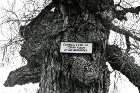
The lushness of grasses drew buffalo into the valley.  It becomes rather obvious why the Native Americans used the area to camp – food, water, fuel – all in abundance.  Just north of the Strauss Cabin, across the railroad tracks, is where the Council Tree was located.  Large numbers of Native Americans could camp in the vicinity to ‘Council’, as the early setters called Native American gatherings, – i.e. transact business, socialize, and conduct ceremonies – while living comfortably on the resources provided by the river. 

This lushness did not escape the attention of earlier settlers to the area.  George Strauss (1858) and Benjamin Eaton (1859), traveling through the area on other missions, noted the lushness and both returned to settle in the valley when their missions were completed.  The Coy family decided to over-winter in the valley on their way to California in 1862, but did not continue their trip when spring arrived.  The Valley is a beautiful place where many people, over the years, have chosen to settle. 

The Northern Arapaho, under the leadership of ‘Chief’ Friday, were the last band of Native Americans to live/visit the Poudre River Valley, being forced out in the late 1860s.  Before leaving, they requested a reservation on the north bank of the Poudre River, on which to live, but were denied.  Friday’s band eventually was assigned to live on the Wind River Indian Reservation in central Wyoming. 


References:

Silkensen, G. 1993. South Platte River Observations: Historical Clues to the Evolution of a River’s Ecology. Published in the Proceedings of the 1992 South Platte Conference, Information Series Number 72, Colorado Water Institute, Colorado State University, pages 41-56. http://www.cwi.colostate.edu/publications/IS/72.pdf

Simmons, Marc. 2004. Friday: the Arapaho Boy – a Story from History. Children of the West Series, University of New Mexico Press, Albuquerque. 

Burris, Lucy. 2006. People of the Poudre: An Ethnohistory of the Cache la Poudre River National Heritage Area, AD 1500-1880. (Published through a cooperative agreement between the National Park Service, Friends of the Poudre, and the Cache la Poudre River National Heritage Area)

Just Add Water: Why is there a National Heritage Area associated with the Cache la Poudre River?

By Stories

The main answer to this question is WATER!  The Poudre River’s water history is not unique in the western U.S. – many western rivers have similar stories about human attempts to survive in arid and semi-arid western river valleys.

What makes the Cache la Poudre River worthy of designation as a National Heritage Area is the manner in which its water history is interwoven into the broader fabric of western water law and technology.  The Poudre River’s history, in many ways, is an illustrative microcosm of western settlement that captures the essence of the struggles people faced in living in the dryness that defines the West and, in particular, how they adapted to survive, and thrive, in the dry landscape.  And further, the Poudre’s history shows how people continue, to this day, to adapt to new challenges, such as improving the ecological health of the river and providing for recreation on, and in, the river.       

As historian David McCullough notes:

History is the story of people. 

Water history in the Poudre River valley is no exception.  The series of stories that follow explains the role of the people of the Poudre in establishing western water law, water development strategies, new water management technology, and initial recognition of the need to create a sustainable relationship with the limited water environment that exists in much of the West.  Again, this need continues today as the population of the Poudre Valley continues to grow rapidly. 

The people did not set out to establish new water law, create new technology to manage water, or determine how to divide the limited waters of western rivers.  They set out to survive in a dry and harsh climate. As the people of the Poudre adapted to the dry climate, their efforts were innovative enough to be of assistance and use to other western States and many foreign countries. 

Organizing and presenting a large sweep of western water history, if even in only one valley, can be daunting if the presentation focuses on each discipline’s (i.e. law, engineering, agriculture, etc.) evolutionary path.  The approach used here will chronologically follow the people of the Poudre, explain the water challenges they faced in their day, and describe the manner in which they solved each challenge.  The solutions they created for each challenge, when combined over time, will help to explain how we arrived, collectively, at the system of western water management in use today and why there is a National Heritage Area associated with the Poudre River. 

Water history in the West is, in very general terms, about subsistence in the 1800s (the frontier was deemed ‘closed’ in 1890), development in the 1900s (the Bureau of Reclamation was created in 1902 and is now managing 180 projects), and sustainability as the 21st Century dawns (as ecosystem health, instream flows and recreational uses are debated, acknowledged, and incorporated into water law).  This overarching framework provides a background against which the people of the Poudre lived their lives and confronted water challenges facing each generation. 

Read the first story.  


References:

‘The Story of People’

National Park Service. 1990. Resource Assessment: Proposed Cache la Poudre River National Heritage Corridor. Prepared by the NPS Rocky Mountain Regional Office at the request of the City of Fort Collins, December  [Appendix B of this report is entitled: Historical Context – The History of Water Law and Water Development in the Cache la Poudre River Basin and the Rocky Mountain West]  Report can be accessed at:  https://archive.org/details/resourceassessme00nati

Information Source: These stories were prepared by Robert C. Ward, a professor and administrator at Colorado State University for 35 years, to assist in training volunteers on the history behind designation of the Poudre River as a National Heritage Area. [In particular, the information permits water history-related sites along the Poudre River to be explained through the lives of people who adapted their use of water to match the semi-arid nature of the landscape.]

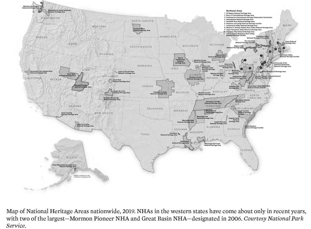
Just Add Water: What is a National Heritage Area?

By Stories

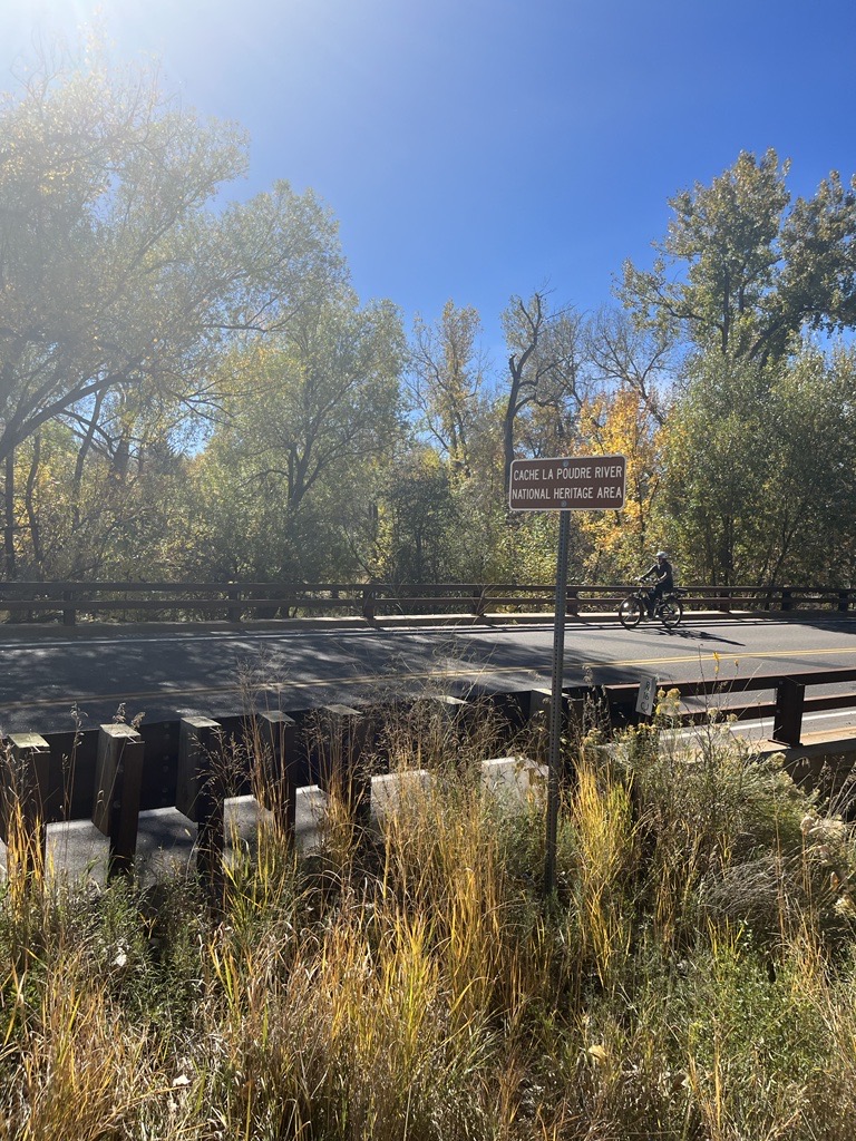
We see signs announcing the Cache la Poudre National Heritage Area when we drive across bridges over the Poudre River and along the Poudre Trail by irrigation ditches.  What is a national heritage area?  Why is there one along the Poudre River?  What does the heritage area encompass?

First, let’s define a National Heritage Area.  According to the National Park Service, that oversees National Heritage Areas:

National Heritage Areas are places where historic, cultural, and natural resources combine to form cohesive, nationally important landscapes.  Unlike national parks, National Heritage Areas are large lived-in landscapes. Consequently, National Heritage Area entities collaborate with communities to determine how to make heritage relevant to local interests and needs. 

In 1984, the first National Heritage Area, Illinois and Michigan Canal National Heritage Area, was signed into law by President Ronald Reagan. In his dedication speech, Reagan referred to National Heritage Areas as “a new kind of national park” that married heritage conservation, recreation, and economic development.

National Park Service. 1990. Proposed Cache la Poudre River National Heritage Corridor: Resource Assessment.

The Cache la Poudre landscape was examined by the National Park Service, in 1990, for consideration as a National Heritage Corridor.  This study was requested by Fort Collins and considered only that portion of the Poudre near Fort Collins.  The recommendations of the study suggested a broader definition of the area covered and, eventually, led to Congress, under the leadership of Senator Hank Brown, establishing the Cache la Poudre River National Heritage Corridor in 1996. 

Implementation of the legislation ran into problems regarding who appointed the Board to oversee the Heritage Area. This problem was not corrected by Congress until 2009.  A Management Plan was prepared in 2013 and the Cache la Poudre River National Heritage Area became a fully funded, and, thus, functioning, National Heritage Area at that time. 

The Cache la Poudre River National Heritage Area’s ‘landscape’ includes the 100-year flood plain of the river from, roughly, the mouth of the Poudre River Canyon, northwest of Bellvue, to the mouth of the river, east of Greeley.   National Heritage Area designation does not affect private property rights. 

References:

National Park Service. 1990. Proposed Cache la Poudre River National Heritage Corridor: Resource Assessment.  Study funded by City of Fort Collins. (https://archive.org/details/resourceassessme00nati) [Appendix B of this document is an excellent overview of the water history behind establishment of the Cache la Poudre River National Heritage Area.]

National Park Service

Information Source: These stories were prepared by Robert C. Ward, a professor and administrator at Colorado State University for 35 years, to assist in training volunteers on the history behind designation of the Poudre River as a National Heritage Area. [In particular, the information permits water history-related sites along the Poudre River to be explained through the lives of people who adapted their use of water to match the semi-arid nature of the landscape.]
Press Release: National Heritage Area Program Bill Passes in House of Representatives, Supports Program Longevity 

By News

NEWS RELEASE 

March 6th, 2021 

For immediate release; for more information, contact: 

Kathleen Benedict, Executive Director 

Poudre Heritage Alliance 

(970)-222-5795 


National Heritage Area Program Bill Passes in House of Representatives, Supports Program Longevity
 

Washington, DC – Colorado, USA (March 6) – The passage of the National Heritage Areas Act of 2021, H.R. 1316, as part of H.R. 803, the Protecting America’s Wilderness and Public Lands Act, on February 26, 2021, standardizes the criteria in which future National Heritage Areas (NHAs) will be designated under and defines structures that will allow more consistent federal support. This will affect all 55 National Heritage Areas, including the three existing ones in Colorado. NHAs are places designated by Congress for their cultural, natural, historic resources that combined tell a nationally significant story about our nation’s diverse heritage.  

The three Colorado Heritage Areas, Cache la Poudre River National Heritage Area (designated in 1996), South Park National Heritage Area (designated in 2009), and Sangre de Cristo National Heritage Area (designated 2009), are currently authorized to only receive appropriated funding for three more years until the year 2024. While not considered National Park Units, NHAs receive technical and financial assistance from the National Park Service who administers the program. Among championing historic preservation, educational programming, and heritage tourism, NHAs generate economic value for their communities, on average $5.50 per $1 of federal funds spent. An Economic Impact Study completed in 2017 by the Poudre Heritage Alliance (the managing entity of the Cache la Poudre River NHA) showed an annual $81.6 million impact on their region and $6.9 million generated in tax revenues. 

The National Heritage Areas Act of 2020, H.R. 1049, would have initially passed in the House of Representatives on December 4th, 2020, but stalled in the Senate. H.R. 1049 would have allowed NHAs to receive an additional ten years of federal funding and had more than 220 cosponsors. The National Heritage Area Act of 2021 has bipartisan support, being sponsored by Representatives Paul D. Tonko (D-NY) and David McKinley (R-WV), and is currently being reviewed in the Senate. 


ABOUT THE CACHE LA POUDRE RIVER NATIONAL HERITAGE AREA AND THE POUDRE HERITAGE ALLIANCE 

The Cache la Poudre River National Heritage Area (CALA), a 45-mile stretch of the Lower Poudre River, tells the story of the river where Western Water Law took shape and how the river still informs the use of water throughout the arid West today.  CALA’s 501(c)3 nonprofit managing entity, the Poudre Heritage Alliance – PROMOTES a variety of historical and cultural opportunities; ENGAGES people in their river corridor; and INSPIRES learning, preservation, and stewardship. Find out more at:  https://poudreheritage.org/ 


### 

Celebrate Success: National Heritage Area’s 2019 Impact Numbers

By News
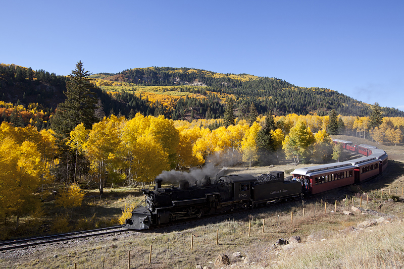
Photo: The Cumbres & Toltec zooms along the tracks in the Sangre de Cristo National Heritage Area in southern Colorado, one of 55 National Heritage Areas in the United States.


From the National Park Service – National Heritage Area’s blog:

National Heritage Areas are a grassroots, community-driven approach to heritage conservation and economic development. Through public-private partnerships, NHA entities support historic preservation, natural resource conservation, recreation, heritage tourism, and educational projects.

Check-out the NHA 2019 impact numbers:

In 2019, NHAs:

  • Leveraged $84.5 million in cash and in-kind support to carry out heritage projects and programs, greatly increasing the impact of the $19.3 million in federal Heritage Partnership Program funding received.
  • Engaged 2,674 formal partners and 5,286 informal partners in heritage area activities.
  • Benefited from 36,289 volunteers contributing over 475,511 hours for heritage area projects – a $12.3 million-dollar value.

Preserving our Heritage. Across the country, National Heritage Areas and their partners are reviving historic downtowns, preserving battlefields and industrial sites, and sharing our nation’s history through the arts. In 2019:

  • 214 historic sites and 13,840 acres of cultural landscapes preserved and maintained, including battlefields. •
  • 104 community development projects were carried-out, including streetscape improvement and art projects. •
  • 55 collections projects undertaken, including the conservation of artifacts and creation of oral histories.
  • 82 historic preservation grants awarded totaling $904,294.

Recreation and Conservation. Through recreational projects such as land and water trails, National Heritage Areas are improving connectivity and accessibility, creating more vibrant and healthy communities. In 2019:

  • 154 recreation projects undertaken.
  • 567 miles of trails maintained and 95 new miles of trails developed.
  • 72 recreation grants awarded totaling $1.2 million.

Conservation activities led by National Heritage Area entities and their partners improve air and water quality and support healthy ecosystems. In 2019:

  • 12,858 acres of land restored and maintained via invasive species removal, replanting and toxic site clean-ups.
  • 54 conservation grants awarded totaling $601,078.

Educating Current and Future Leaders. Through programs such as Journey Through Hallowed Ground National Heritage Area’s National History Academy. National Heritage Areas and their partners are providing meaningful and inspirational connections to our nation’s heritage and exploring the qualities and skills of leadership. In 2019:

  • Capacity-building assistance provided to 1,162 organizations.
  • 302 educational programs were offered.
  • 2,700 grants to support educational programs were awarded totaling $2.1 million.

To learn more about National Heritage Areas please visit: https://www.nps.gov/subjects/heritageareas/index.htm