Tag

water

Just Add Water: Pre-settlement Water, Land, People Relationships in the Poudre River Valley

By Stories

The Poudre River’s recorded history, prior to gold seekers and settlers arriving in the late 1850s and early 1860s, is scarce.  There were fur trappers’ and explorers’ writings of the area, but these were very limited regarding the Poudre River.  It was during this period that the river obtained its name, but the exact reasons and timing are uncertain.  It is generally agreed that fur traders/trappers needed to stash some of their supplies (including gun powder – in French it becomes ‘Cache la Poudre’), for a short time, during the 1820s or 1830s, for some reason, and the river was named for this action. 

As gold seekers and settlers encountered the Poudre River Valley in the mid-1800s, I often wonder what they saw.  We know that the river today is not like the natural stream before it was adapted to support permanent settlement of large numbers of people.   

Before permanent settlement in the Poudre River valley, the river meandered in a shallow, braided fashion through the bottomlands.  Each spring, runoff flooded (i.e. ‘irrigated’) the valley bottomlands in such a manner that there was an excellent stand of native grasses growing across the valley floor from the mouth of the canyon to the mouth of the river, east of Greeley.  One place, open to the public, to visualize this low, flat, bottomlands is the Arapaho Bends Natural Area.  As you stand near the remains of the Strauss Cabin, you can gaze across the valley floor (removing Rigden Reservoir from visualization) toward the west and see the bluff with Ziegler Road on top.  Look east to the bluff where I-25 is now located with the town of Timnath on the east side of the interstate.  Looking upstream the valley widens as the Box Elder Creek enters the Poudre River.  Imagine the entire bottomland area covered with native grasses and trees growing along the river meandering through the valley. 

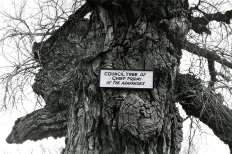
The lushness of grasses drew buffalo into the valley.  It becomes rather obvious why the Native Americans used the area to camp – food, water, fuel – all in abundance.  Just north of the Strauss Cabin, across the railroad tracks, is where the Council Tree was located.  Large numbers of Native Americans could camp in the vicinity to ‘Council’, as the early setters called Native American gatherings, – i.e. transact business, socialize, and conduct ceremonies – while living comfortably on the resources provided by the river. 

This lushness did not escape the attention of earlier settlers to the area.  George Strauss (1858) and Benjamin Eaton (1859), traveling through the area on other missions, noted the lushness and both returned to settle in the valley when their missions were completed.  The Coy family decided to over-winter in the valley on their way to California in 1862, but did not continue their trip when spring arrived.  The Valley is a beautiful place where many people, over the years, have chosen to settle. 

The Northern Arapaho, under the leadership of ‘Chief’ Friday, were the last band of Native Americans to live/visit the Poudre River Valley, being forced out in the late 1860s.  Before leaving, they requested a reservation on the north bank of the Poudre River, on which to live, but were denied.  Friday’s band eventually was assigned to live on the Wind River Indian Reservation in central Wyoming. 


References:

Silkensen, G. 1993. South Platte River Observations: Historical Clues to the Evolution of a River’s Ecology. Published in the Proceedings of the 1992 South Platte Conference, Information Series Number 72, Colorado Water Institute, Colorado State University, pages 41-56. http://www.cwi.colostate.edu/publications/IS/72.pdf

Simmons, Marc. 2004. Friday: the Arapaho Boy – a Story from History. Children of the West Series, University of New Mexico Press, Albuquerque. 

Burris, Lucy. 2006. People of the Poudre: An Ethnohistory of the Cache la Poudre River National Heritage Area, AD 1500-1880. (Published through a cooperative agreement between the National Park Service, Friends of the Poudre, and the Cache la Poudre River National Heritage Area)

Just Add Water: Why is there a National Heritage Area associated with the Cache la Poudre River?

By Stories

The main answer to this question is WATER!  The Poudre River’s water history is not unique in the western U.S. – many western rivers have similar stories about human attempts to survive in arid and semi-arid western river valleys.

What makes the Cache la Poudre River worthy of designation as a National Heritage Area is the manner in which its water history is interwoven into the broader fabric of western water law and technology.  The Poudre River’s history, in many ways, is an illustrative microcosm of western settlement that captures the essence of the struggles people faced in living in the dryness that defines the West and, in particular, how they adapted to survive, and thrive, in the dry landscape.  And further, the Poudre’s history shows how people continue, to this day, to adapt to new challenges, such as improving the ecological health of the river and providing for recreation on, and in, the river.       

As historian David McCullough notes:

History is the story of people. 

Water history in the Poudre River valley is no exception.  The series of stories that follow explains the role of the people of the Poudre in establishing western water law, water development strategies, new water management technology, and initial recognition of the need to create a sustainable relationship with the limited water environment that exists in much of the West.  Again, this need continues today as the population of the Poudre Valley continues to grow rapidly. 

The people did not set out to establish new water law, create new technology to manage water, or determine how to divide the limited waters of western rivers.  They set out to survive in a dry and harsh climate. As the people of the Poudre adapted to the dry climate, their efforts were innovative enough to be of assistance and use to other western States and many foreign countries. 

Organizing and presenting a large sweep of western water history, if even in only one valley, can be daunting if the presentation focuses on each discipline’s (i.e. law, engineering, agriculture, etc.) evolutionary path.  The approach used here will chronologically follow the people of the Poudre, explain the water challenges they faced in their day, and describe the manner in which they solved each challenge.  The solutions they created for each challenge, when combined over time, will help to explain how we arrived, collectively, at the system of western water management in use today and why there is a National Heritage Area associated with the Poudre River. 

Water history in the West is, in very general terms, about subsistence in the 1800s (the frontier was deemed ‘closed’ in 1890), development in the 1900s (the Bureau of Reclamation was created in 1902 and is now managing 180 projects), and sustainability as the 21st Century dawns (as ecosystem health, instream flows and recreational uses are debated, acknowledged, and incorporated into water law).  This overarching framework provides a background against which the people of the Poudre lived their lives and confronted water challenges facing each generation. 

Read the first story.  


References:

‘The Story of People’

National Park Service. 1990. Resource Assessment: Proposed Cache la Poudre River National Heritage Corridor. Prepared by the NPS Rocky Mountain Regional Office at the request of the City of Fort Collins, December  [Appendix B of this report is entitled: Historical Context – The History of Water Law and Water Development in the Cache la Poudre River Basin and the Rocky Mountain West]  Report can be accessed at:  https://archive.org/details/resourceassessme00nati

Information Source: These stories were prepared by Robert C. Ward, a professor and administrator at Colorado State University for 35 years, to assist in training volunteers on the history behind designation of the Poudre River as a National Heritage Area. [In particular, the information permits water history-related sites along the Poudre River to be explained through the lives of people who adapted their use of water to match the semi-arid nature of the landscape.]
Just Add Water: What is a National Heritage Area?

By Stories

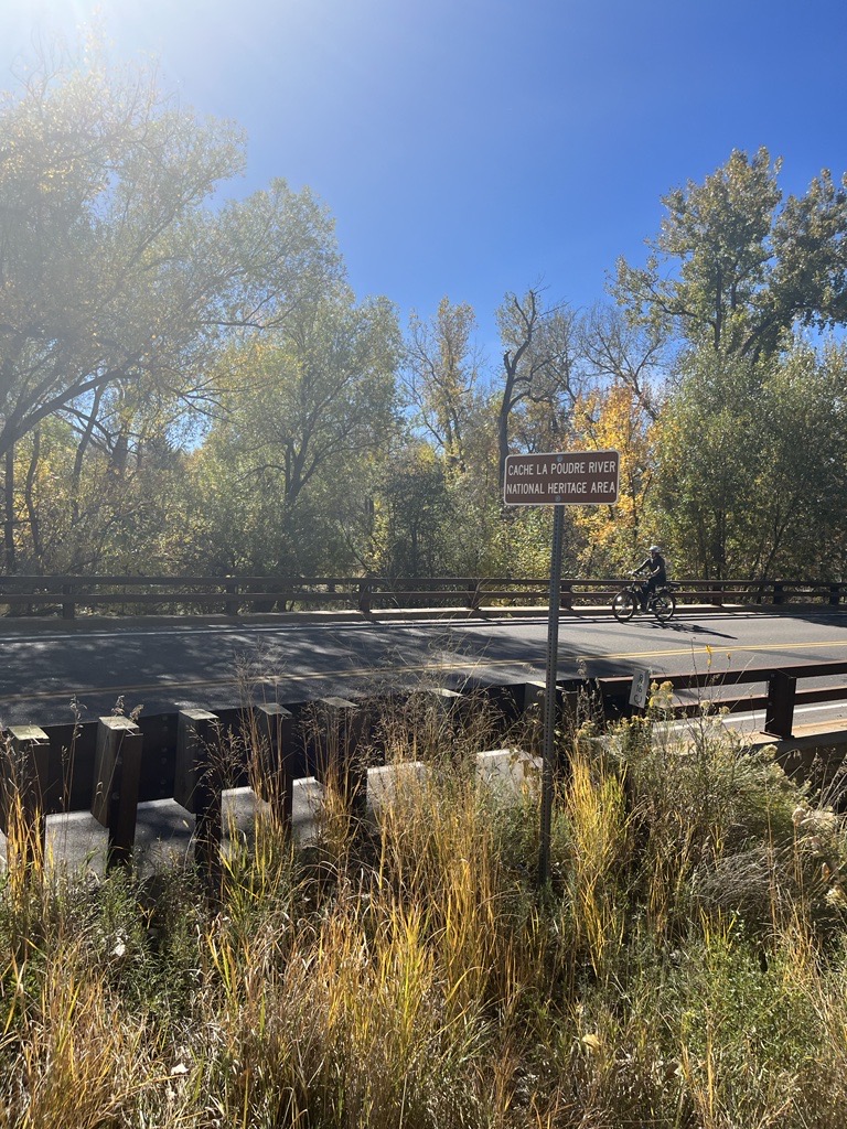
We see signs announcing the Cache la Poudre National Heritage Area when we drive across bridges over the Poudre River and along the Poudre Trail by irrigation ditches.  What is a national heritage area?  Why is there one along the Poudre River?  What does the heritage area encompass?

First, let’s define a National Heritage Area.  According to the National Park Service, that oversees National Heritage Areas:

National Heritage Areas are places where historic, cultural, and natural resources combine to form cohesive, nationally important landscapes.  Unlike national parks, National Heritage Areas are large lived-in landscapes. Consequently, National Heritage Area entities collaborate with communities to determine how to make heritage relevant to local interests and needs. 

In 1984, the first National Heritage Area, Illinois and Michigan Canal National Heritage Area, was signed into law by President Ronald Reagan. In his dedication speech, Reagan referred to National Heritage Areas as “a new kind of national park” that married heritage conservation, recreation, and economic development.

National Park Service. 1990. Proposed Cache la Poudre River National Heritage Corridor: Resource Assessment.

The Cache la Poudre landscape was examined by the National Park Service, in 1990, for consideration as a National Heritage Corridor.  This study was requested by Fort Collins and considered only that portion of the Poudre near Fort Collins.  The recommendations of the study suggested a broader definition of the area covered and, eventually, led to Congress, under the leadership of Senator Hank Brown, establishing the Cache la Poudre River National Heritage Corridor in 1996. 

Implementation of the legislation ran into problems regarding who appointed the Board to oversee the Heritage Area. This problem was not corrected by Congress until 2009.  A Management Plan was prepared in 2013 and the Cache la Poudre River National Heritage Area became a fully funded, and, thus, functioning, National Heritage Area at that time. 

The Cache la Poudre River National Heritage Area’s ‘landscape’ includes the 100-year flood plain of the river from, roughly, the mouth of the Poudre River Canyon, northwest of Bellvue, to the mouth of the river, east of Greeley.   National Heritage Area designation does not affect private property rights. 

References:

National Park Service. 1990. Proposed Cache la Poudre River National Heritage Corridor: Resource Assessment.  Study funded by City of Fort Collins. (https://archive.org/details/resourceassessme00nati) [Appendix B of this document is an excellent overview of the water history behind establishment of the Cache la Poudre River National Heritage Area.]

National Park Service

Information Source: These stories were prepared by Robert C. Ward, a professor and administrator at Colorado State University for 35 years, to assist in training volunteers on the history behind designation of the Poudre River as a National Heritage Area. [In particular, the information permits water history-related sites along the Poudre River to be explained through the lives of people who adapted their use of water to match the semi-arid nature of the landscape.]
Yuma’s Heritage Area Benefits Local Recreation and Fishing

By News

This article is a good shout-out to our Heritage Area partners over there in Yuma. Keep up the good work! For the full article, click here:

Excerpt from “An Underrated Bass Fishery United This Town on the Colorado River”:

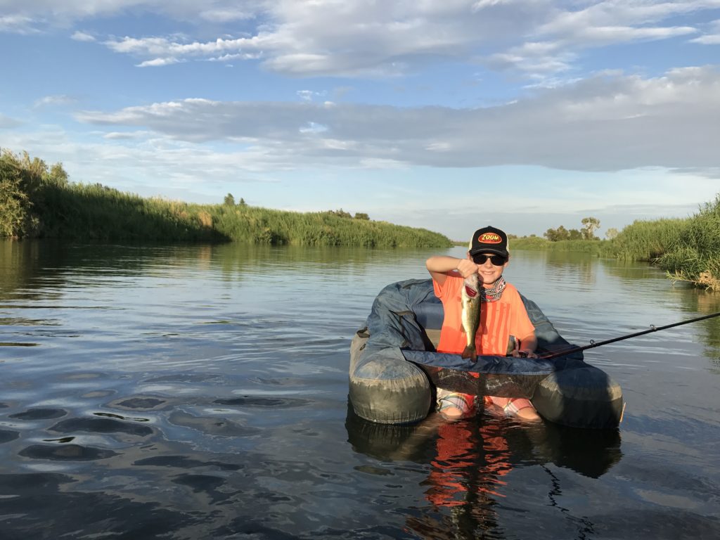
“It was 107 degrees in the September sun in Yuma, Arizona, and yet people were out bass fishing. Twenty years ago, this would not have been the case. But Yuma’s renewed focus on its river, the mighty Colorado, is an extraordinary story of diplomacy and determination that has resulted in benefits for the local economy, outdoor recreation, and Yuma’s people. I was able to witness this firsthand on a recent canoe trip through the Yuma Heritage Area’s wetlands restoration sites, through the downtown park—now vibrant after struggling in the late 20th century —to below the Ocean to Ocean (“peace”) bridge—rebuilt quite literally to bring together residents of Yuma on the river’s east bank with members of the Quechan Reservation on its west bank, with whom relations had been poor.”

Photo courtesy of J. Jakobson.

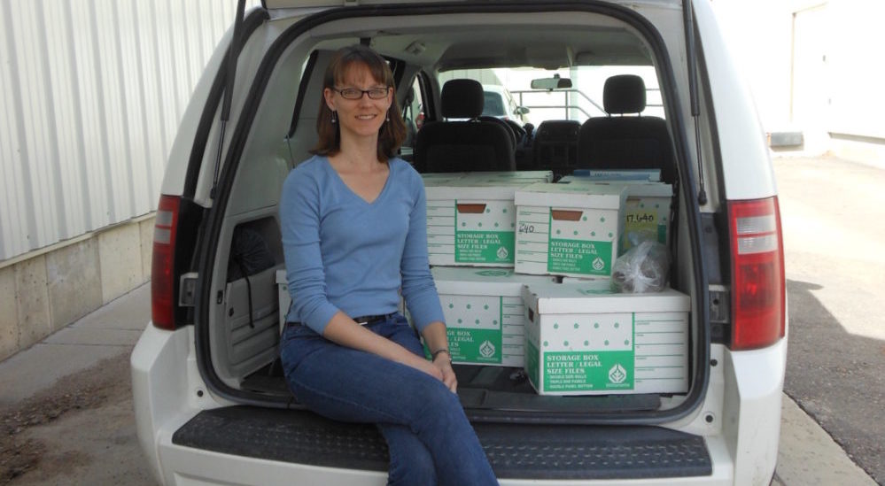
Colorado State University Spotlights Water Resources Archivisit, Patty Rettig

By News

Exerpt from full article: https://source.colostate.edu/provosts-council-engagement-spotlight-patty-rettig/

How have you, your program or students benefitted from what you have learned as an engaged faculty member? And, has there been any sort of reciprocity – or two-way learning – with the communities outside of CSU that you have been involved with?

An archival repository that collects historically important materials from outside its home institution is inherently dependent on engaging with the appropriate communities. The Water Resources Archive cannot be isolated and effective at the same time. From the beginning of the Archive in 2001, with the assistance of numerous university water folks along the way, I have been active in the Colorado water community, listening to issues, learning about organizations, and meeting individuals.

The outcome of my work, as far as saving and making available historically important water-related documents, benefits not only students who might be interested in using such materials for research, but also the whole state and anyone around the world who might want to learn about the important achievements related to Colorado water. The water community also benefits not only through having their heritage prioritized, preserved, and honored here, but also through events we have held, such as Water Tables, which allows them to both learn from us and teach us – and each other – more about our common history.

The best example of reciprocity that I have is a recent one, when I began working with the Land Rights Council in the San Luis Valley. They needed assistance with their historical documents and, though wary of outsiders, were open to discussions about the Water Resources Archive’s expertise. I in turn learned a great deal about their needs and concerns, and it has resulted in the start of a great partnership to preserve their history.

Unheard Voices: People of the Poudre Presentation

By News

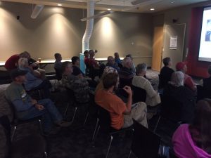
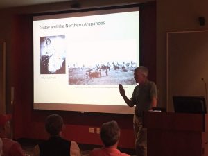
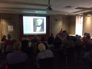
Heritage Culturalist Volunteers Denise Fisher and Robert Ward presented on the Northern Arapaho people along the Cache la Poudre River National Heritage Area on Friday September 22 at the Farr Regional Library in Greeley, CO. The event spurred interesting discussion and fostered intriguing questions. It also highlighted the Poudre Heritage Alliance’s Video Series on the Northern Arapaho, which can be found here. The speaker series continues with talks on September 29 and October 6. See above for more info.

Larimer County, Broomfield Finalize Innovative Water Agreement

By News

LOVELAND, Colo. – Larimer County Department of Natural Resources and the City and County of Broomfield have finalized an innovative water-sharing agreement that keeps a working farm in production while helping fill municipal water needs. The deal closed Tuesday, August 22.

In 2016, Larimer County purchased a farm and its associated water rights southwest of Berthoud with the goal of keeping the farm in active production while offsetting the cost through a water-sharing agreement. After studies by experts in the fields of water, engineering, economics and agriculture, Larimer County determined the amount of water the farm would need to remain viable in perpetuity. Larimer County and Broomfield then entered into an agreement where some of the unneeded water would be purchased by Broomfield outright and a portion of the water would be shared by the two counties in drought years.

This agreement, known as an Alternative Transfer Method (ATM), is the first of its kind in Colorado where water is shared from agricultural to municipal use in perpetuity. ATMs are promoted in the 2015 Colorado Water Plan as a way to provide drought water to cities without permanently drying up productive farmland.

Check out the full article here.

New study to show massive volume of water Colorado gives up to other states

By News

Check out an interesting article about the complexities of water management: inter-state compacts, in-stream storage, building reservoirs, Western Slope versus Eastern Slope, agricultural/municipal/industrial water use, and more!

New study to show massive volume of water Colorado gives up to other states

(Picture above: South Platte in Denver–Photo by Mr.TinDC via Creative commons license, Flickr)

Smithsonian Exhibition Exploring the Global Water Story

By News

Smithsonian Exhibition Exploring the Global Water Story
Scheduled to Open at the Greeley History Museum

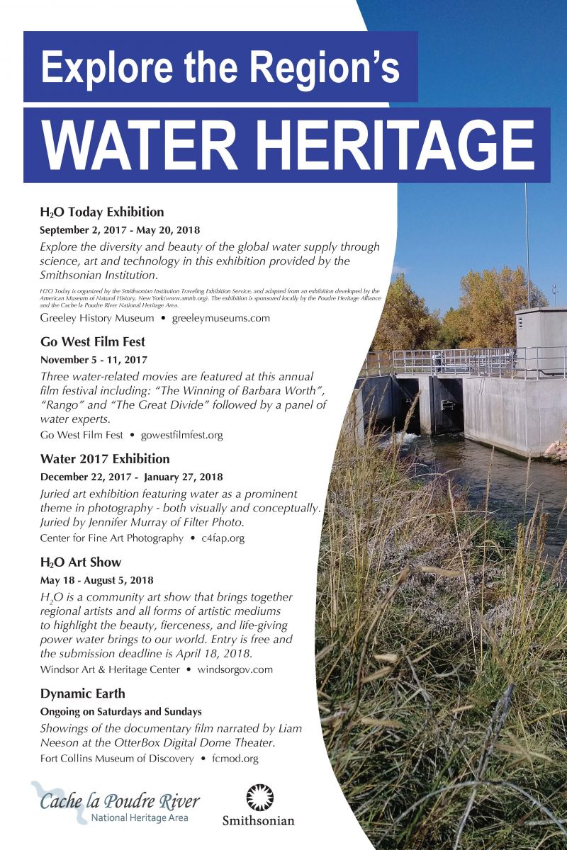
GREELEY, CO— Water is the most vital resource for life on Earth; no living thing exists without it. “H2O Today”—a new exhibition at the Greeley History Museum, 714 8th St.—examines the diversity and challenges of global water sources and promotes conversation, creativity and innovation through art, science and technology. Organized by the Smithsonian Institution Traveling Exhibition Service (SITES), the exhibition will be available locally from Saturday, Sept. 2 through Sunday, May 20, 2018.

“H2O Today” dives into what it means to live on a planet where 71 percent of the surface is covered in water, yet less than 3 percent is drinkable. The exhibition highlights the crucial role it plays in daily life through water power, industry, agriculture and home use. Visitors will learn the affects climate change, population growth and pollution have on the water cycle and weather patterns as well as the creative ways people around the world are tackling the challenges of water shortages and pollution.

Local artifacts on display include items related to the Greeley Ice and Storage Company, and a water clock used to measure water levels at the head gate for Union Colony Ditch No.3. Visitors will also have an opportunity to learn about irrigation and use an example treadle pump to see how the pump moves water.

The “H2O Today” exhibition is part of the Smithsonian’s Think Water Initiative to raise awareness of water as a critical resource for life through exhibitions, educational resources and public programs. The public can participate in the conversation on social media at #thinkWater.

“H20 Today” was adapted by SITES from an exhibition organized by the American Museum of Natural History in New York City (Amnh.org) and the Science Museum of Minnesota in St. Paul (Smm.org), in collaboration with Great Lakes Science Center in Cleveland; The Field Museum in Chicago; Instituto Sangari in Sao Paulo; National Museum of Australia in Canberra; Royal Ontario Museum in Toronto, Canada; San Diego Natural History Museum; and Science Centre Singapore with PUB Singapore.

The exhibit is sponsored locally by the Cache la Poudre River National Heritage Area and the 501(c)3 non-profit management entity of the heritage area, the Poudre Heritage Alliance.

For hours of operation and information about this and other exhibits on display at the Greeley History Museum, visit GreeleyMuseums.com.

###

SITES has been sharing the wealth of Smithsonian collections and research programs with millions of people outside Washington, D.C., for 65 years. SITES connects Americans to their shared cultural heritage through a wide range of exhibitions about art, science and history, which are shown wherever people live, work and play. For exhibition descriptions and tour schedules, visit Sites.si.edu.